Saint-Planchers geodata
Saint-Planchers (Normandy) is a populated place; located in France in Europe/Paris (GMT+2) time zone. With population of 1,158 people, there are 7774 cities with bigger population in this country. Compared to other cities in France, 76% of cities are located further ↓South; 92.4% of cities are located further →East and 83.1% of cities have higher elevation than Saint-Planchers. Note1
Administrative division(s):
- Level 1: Normandy
- Level 2: Manche
- Level 3: Avranches
- Level 4: Saint-Planchers


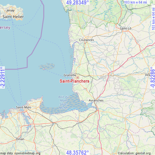
Saint-Planchers GPS coordinates[2]
48° 49' 21.684" North, 1° 31' 33.528" West
| Map corner | latitude | longitude |
|---|---|---|
| Upper-left | 49.28349°, | -2.22911° |
| Center: | 48.82269°, | -1.52598° |
| Lower-right: | 48.35762°, | -0.82286° |
| Map W x H: | 102.9×102.9 km | = 63.9×63.9mi |
| max Lat: | 51.07786° ⇑24% North |
| Saint-Planchers: | 48.82269° |
| min Lat: | ⇓76% South 41.3874° |
| min Long | Saint-Planchers | max Long |
| -5.08615° | -1.52598° | 9.52242° |
| W 7.6%⇐ | ⇒92.4% E |
Elevation
Elevation of Saint-Planchers is 47 m = 154 ft, and this is 146.7 m = 481 ft below average elevation for this country.
| Max E: |
2333 m = 7654 ft | 83.1% |
| Avg. | 193.7 m = 635 ft | |
| Saint-Planchers | 47 m = 154 ft | |
Min E: |
-1 m = -3 ft | 16.9% |
See also: France elevation on elevation.city.
Geographical zone
Saint-Planchers is located in North temperate zone (between Tropic of Cancer and the Arctic Circle). Distance of this North polar circle is 1972.6 km =1225.7 mi to North.| Distance of | km | miles | from Saint-Planchers |
|---|---|---|---|
| North Pole | 4578.5 | 2844.9 | to North |
| Arctic Circle | 1972.6 | 1225.7 | to North |
| Tropic Cancer | 2822.7 | 1753.9 | to South |
| Equator | 5428.6 | 3373.2 | to South |


Nearby cities:
15 places around Saint-Planchers: (largest is in red/bold)
• Bricqueville-sur-Mer
10.1 km =6.3 mi,  2°
2°
• Bréhal
8.6 km =5.3 mi,  6°
6°
• Bréville-sur-Mer
5.3 km =3.3 mi,  334°
334°
• Carolles
8.4 km =5.2 mi,  197°
197°
• Coudeville-sur-Mer
6.5 km =4 mi,  359°
359°
• Donville-les-Bains
4.9 km =3 mi,  301°
301°
• Folligny
8.4 km =5.2 mi,  88°
88°
• Granville
5.5 km =3.4 mi,  288°
288°
• Hudimesnil
5.1 km =3.2 mi,  28°
28°
• Jullouville
5.9 km =3.7 mi,  207°
207°
• La Haye-Pesnel
9.9 km =6.2 mi,  107°
107°
• Saint-Jean-des-Champs
4.5 km =2.8 mi,  82°
82°
• Saint-Pair-sur-Mer
3.2 km =2 mi,  253°
253°
• Sartilly
9.3 km =5.8 mi,  147°
147°
• Yquelon
3.6 km =2.2 mi,  322°
322°
Sources, notices
• [Note1] Compared only with cities in France existing in our database
• [Src1] Map data: © OpenStreetMap contributors (CC-BY-SA)
• [Src2] Other city data from geonames.org with taken over terms of usage.
• [Src3] Geographical zone / Annual Mean Temperature by Robert A. Rohde @ Wikipedia
