Sartilly geodata
Sartilly (Normandy) is a populated place; located in France in Europe/Paris (GMT+2) time zone. With population of 1,318 people, there are 6947 cities with bigger population in this country. Compared to other cities in France, 74.4% of cities are located further ↓South; 91.9% of cities are located further →East and 58.3% of cities have higher elevation than Sartilly. Note1
Administrative division(s):
- Level 1: Normandy
- Level 2: Manche
- Level 3: Avranches
- Level 4: Sartilly-Baie-Bocage


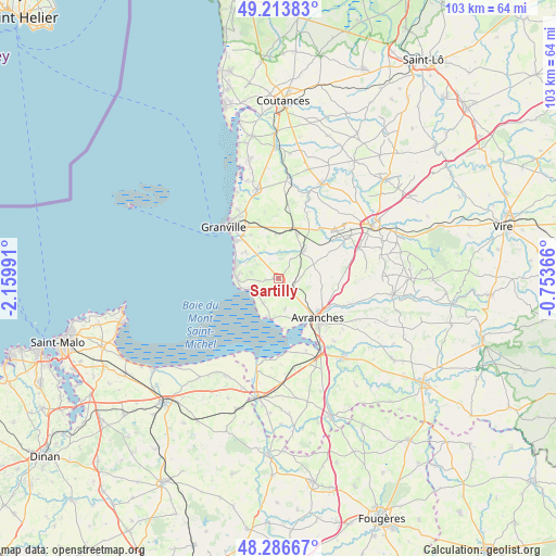
Sartilly GPS coordinates[2]
48° 45' 8.604" North, 1° 27' 24.408" West
| Map corner | latitude | longitude |
|---|---|---|
| Upper-left | 49.21383°, | -2.15991° |
| Center: | 48.75239°, | -1.45678° |
| Lower-right: | 48.28667°, | -0.75366° |
| Map W x H: | 103.1×103.1 km | = 64.1×64.1mi |
| max Lat: | 51.07786° ⇑25.6% North |
| Sartilly: | 48.75239° |
| min Lat: | ⇓74.4% South 41.3874° |
| min Long | Sartilly | max Long |
| -5.08615° | -1.45678° | 9.52242° |
| W 8.1%⇐ | ⇒91.9% E |
Elevation
Elevation of Sartilly is 107 m = 351 ft, and this is 86.7 m = 284 ft below average elevation for this country.
| Max E: |
2333 m = 7654 ft | 58.3% |
| Avg. | 193.7 m = 635 ft | |
| Sartilly | 107 m = 351 ft | |
Min E: |
-1 m = -3 ft | 41.7% |
See also: France elevation on elevation.city.
Geographical zone
Sartilly is located in North temperate zone (between Tropic of Cancer and the Arctic Circle). Distance of this North polar circle is 1980.4 km =1230.6 mi to North.| Distance of | km | miles | from Sartilly |
|---|---|---|---|
| North Pole | 4586.3 | 2849.8 | to North |
| Arctic Circle | 1980.4 | 1230.6 | to North |
| Tropic Cancer | 2814.8 | 1749 | to South |
| Equator | 5420.8 | 3368.3 | to South |


Nearby cities:
15 places around Sartilly: (largest is in red/bold)
• Avranches
10.5 km =6.5 mi,  135°
135°
• Bacilly
5.8 km =3.6 mi,  168°
168°
• Carolles
7.6 km =4.7 mi,  268°
268°
• Dragey-Ronthon
5.1 km =3.2 mi,  218°
218°
• Folligny
8.7 km =5.4 mi,  22°
22°
• Jullouville
8.3 km =5.2 mi,  288°
288°
• La Haye-Pesnel
6.5 km =4 mi,  42°
42°
• Le Val-Saint-Père
11.7 km =7.3 mi,  149°
149°
• Lolif
5.1 km =3.2 mi,  114°
114°
• Marcey-les-Grèves
7.8 km =4.8 mi, 142°
• Saint-Jean-des-Champs
8.4 km =5.2 mi,  355°
355°
• Saint-Pair-sur-Mer
10.7 km =6.6 mi,  310°
310°
• Saint-Planchers
9.3 km =5.8 mi,  327°
327°
• Saint-Senier-sous-Avranches
11.9 km =7.4 mi,  129°
129°
• Vains
8.6 km =5.3 mi,  158°
158°
Sources, notices
• [Note1] Compared only with cities in France existing in our database
• [Src1] Map data: © OpenStreetMap contributors (CC-BY-SA)
• [Src2] Other city data from geonames.org with taken over terms of usage.
• [Src3] Geographical zone / Annual Mean Temperature by Robert A. Rohde @ Wikipedia
