Saint-Pierre-lès-Nemours geodata
Saint-Pierre-lès-Nemours (Île-de-France) is a populated place; located in France in Europe/Paris (GMT+2) time zone. With population of 6,435 people, there are 1536 cities with bigger population in this country. Compared to other cities in France, 63.9% of cities are located further ↓South; 53.2% of cities are located further ←West and 71% of cities have higher elevation than Saint-Pierre-lès-Nemours. Note1
Administrative division(s):
- Level 1: Île-de-France
- Level 2: Seine-et-Marne
- Level 3: Arrondissement de Fontainebleau
- Level 4: Saint-Pierre-lès-Nemours
Current local time in Saint-Pierre-lès-Nemours:
08:15 AM, SaturdayDifference from your time zone: hours


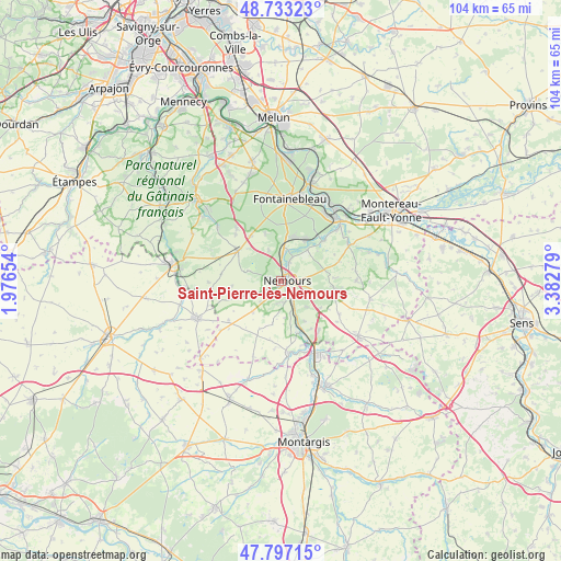
Saint-Pierre-lès-Nemours GPS coordinates[2]
48° 16' 2.388" North, 2° 40' 46.776" East
| Map corner | latitude | longitude |
|---|---|---|
| Upper-left | 48.73323°, | 1.97654° |
| Center: | 48.26733°, | 2.67966° |
| Lower-right: | 47.79715°, | 3.38279° |
| Map W x H: | 104.1×104.1 km | = 64.7×64.7mi |
| max Lat: | 51.07786° ⇑36.1% North |
| Saint-Pierre-lès-Nemours: | 48.26733° |
| min Lat: | ⇓63.9% South 41.3874° |
| min Long | Saint-Pierre-l� | max Long |
| -5.08615° | 2.67966° | 9.52242° |
| W 53.2%⇐ | ⇒46.8% E |
Elevation
Elevation of Saint-Pierre-lès-Nemours is 76 m = 249 ft, and this is 117.7 m = 386 ft below average elevation for this country.
| Max E: |
2333 m = 7654 ft | 71% |
| Avg. | 193.7 m = 635 ft | |
| Saint-Pierre-lès-Nemours | 76 m = 249 ft | |
Min E: |
-1 m = -3 ft | 29% |
See also: France elevation on elevation.city.
Geographical zone
Saint-Pierre-lès-Nemours is located in North temperate zone (between Tropic of Cancer and the Arctic Circle). Distance of this North polar circle is 2034.4 km =1264.1 mi to North.| Distance of | km | miles | from Saint-Pierre-lès-Nemours |
|---|---|---|---|
| North Pole | 4640.2 | 2883.3 | to North |
| Arctic Circle | 2034.4 | 1264.1 | to North |
| Tropic Cancer | 2760.9 | 1715.5 | to South |
| Equator | 5366.8 | 3334.8 | to South |


Nearby cities:
15 places around Saint-Pierre-lès-Nemours: (largest is in red/bold)
• Bagneaux-sur-Loing
4.3 km =2.7 mi,  152°
152°
• Bougligny
8 km =5 mi,  191°
191°
• Bourron-Marlotte
8.3 km =5.2 mi,  10°
10°
• Darvault
3.8 km =2.4 mi,  86°
86°
• Grez-sur-Loing
5.6 km =3.5 mi, 6°
• La Genevraye
7.6 km =4.7 mi,  39°
39°
• Larchant
6.6 km =4.1 mi,  287°
287°
• Montcourt-Fromonville
4.8 km =3 mi,  22°
22°
• Montigny-sur-Loing
9 km =5.6 mi,  32°
32°
• Nanteau-sur-Lunain
9.8 km =6.1 mi,  96°
96°
• Nemours
1.2 km =0.7 mi, 43°
• Nonville
8.6 km =5.3 mi,  78°
78°
• Poligny
6.8 km =4.2 mi,  134°
134°
• Recloses
9.2 km =5.7 mi,  342°
342°
• Villiers-sous-Grez
6.2 km =3.9 mi, 337°
Sources, notices
• [Note1] Compared only with cities in France existing in our database
• [Src1] Map data: © OpenStreetMap contributors (CC-BY-SA)
• [Src2] Other city data from geonames.org with taken over terms of usage.
• [Src3] Geographical zone / Annual Mean Temperature by Robert A. Rohde @ Wikipedia
