Montcourt-Fromonville geodata
Montcourt-Fromonville (Île-de-France) is a populated place; located in France in Europe/Paris (GMT+2) time zone. With population of 2,480 people, there are 3916 cities with bigger population in this country. Compared to other cities in France, 64.7% of cities are located further ↓South; 53.5% of cities are located further ←West and 78.6% of cities have higher elevation than Montcourt-Fromonville. Note1
Administrative division(s):
- Level 1: Île-de-France
- Level 2: Seine-et-Marne
- Level 3: Arrondissement de Fontainebleau
- Level 4: Montcourt-Fromonville
Current local time in Montcourt-Fromonville:
08:15 AM, SaturdayDifference from your time zone: hours


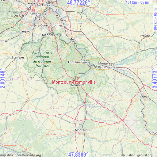
Montcourt-Fromonville GPS coordinates[2]
48° 18' 24.192" North, 2° 42' 16.56" East
| Map corner | latitude | longitude |
|---|---|---|
| Upper-left | 48.77226°, | 2.00148° |
| Center: | 48.30672°, | 2.7046° |
| Lower-right: | 47.8369°, | 3.40773° |
| Map W x H: | 104×104 km | = 64.6×64.6mi |
| max Lat: | 51.07786° ⇑35.3% North |
| Montcourt-Fromonville: | 48.30672° |
| min Lat: | ⇓64.7% South 41.3874° |
| min Long | Montcourt-Fromo | max Long |
| -5.08615° | 2.7046° | 9.52242° |
| W 53.5%⇐ | ⇒46.5% E |
Elevation
Elevation of Montcourt-Fromonville is 58 m = 190 ft, and this is 135.7 m = 445 ft below average elevation for this country.
| Max E: |
2333 m = 7654 ft | 78.6% |
| Avg. | 193.7 m = 635 ft | |
| Montcourt-Fromonville | 58 m = 190 ft | |
Min E: |
-1 m = -3 ft | 21.4% |
See also: France elevation on elevation.city.
Geographical zone
Montcourt-Fromonville is located in North temperate zone (between Tropic of Cancer and the Arctic Circle). Distance of this North polar circle is 2030 km =1261.4 mi to North.| Distance of | km | miles | from Montcourt-Fromonville |
|---|---|---|---|
| North Pole | 4635.9 | 2880.6 | to North |
| Arctic Circle | 2030 | 1261.4 | to North |
| Tropic Cancer | 2765.3 | 1718.3 | to South |
| Equator | 5371.2 | 3337.5 | to South |


Nearby cities:
15 places around Montcourt-Fromonville: (largest is in red/bold)
• Bagneaux-sur-Loing
8.2 km =5.1 mi,  178°
178°
• Bourron-Marlotte
3.8 km =2.4 mi,  355°
355°
• Darvault
4.6 km =2.9 mi,  154°
154°
• Grez-sur-Loing
1.7 km =1.1 mi,  315°
315°
• La Genevraye
3.4 km =2.1 mi,  63°
63°
• Larchant
8.5 km =5.3 mi,  253°
253°
• Montigny-sur-Loing
4.4 km =2.7 mi,  42°
42°
• Nemours
3.7 km =2.3 mi,  196°
196°
• Nonville
7.1 km =4.4 mi,  112°
112°
• Recloses
6.4 km =4 mi,  314°
314°
• Saint-Pierre-lès-Nemours
4.8 km =3 mi, 202°
• Ury
8.6 km =5.3 mi,  298°
298°
• Villemer
8.9 km =5.5 mi,  94°
94°
• Villiers-sous-Grez
4.4 km =2.7 mi,  287°
287°
• Épisy
6.8 km =4.2 mi, 62°
Sources, notices
• [Note1] Compared only with cities in France existing in our database
• [Src1] Map data: © OpenStreetMap contributors (CC-BY-SA)
• [Src2] Other city data from geonames.org with taken over terms of usage.
• [Src3] Geographical zone / Annual Mean Temperature by Robert A. Rohde @ Wikipedia
