Nemours geodata
Nemours (Île-de-France) is a populated place; located in France in Europe/Paris (GMT+2) time zone. With population of 13,933 people, there are 679 cities with bigger population in this country. Compared to other cities in France, 64.1% of cities are located further ↓South; 53.3% of cities are located further ←West and 79% of cities have higher elevation than Nemours. Note1
Administrative division(s):
- Level 1: Île-de-France
- Level 2: Seine-et-Marne
- Level 3: Arrondissement de Fontainebleau
- Level 4: Nemours


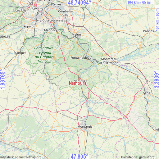
Nemours GPS coordinates[2]
48° 16' 30.396" North, 2° 41' 26.808" East
| Map corner | latitude | longitude |
|---|---|---|
| Upper-left | 48.74094°, | 1.98765° |
| Center: | 48.27511°, | 2.69078° |
| Lower-right: | 47.805°, | 3.3939° |
| Map W x H: | 104.1×104.1 km | = 64.7×64.7mi |
| max Lat: | 51.07786° ⇑35.9% North |
| Nemours: | 48.27511° |
| min Lat: | ⇓64.1% South 41.3874° |
| min Long | Nemours | max Long |
| -5.08615° | 2.69078° | 9.52242° |
| W 53.3%⇐ | ⇒46.7% E |
Elevation
Elevation of Nemours is 57 m = 187 ft, and this is 136.7 m = 448 ft below average elevation for this country.
| Max E: |
2333 m = 7654 ft | 79% |
| Avg. | 193.7 m = 635 ft | |
| Nemours | 57 m = 187 ft | |
Min E: |
-1 m = -3 ft | 21% |
See also: France elevation on elevation.city.
Geographical zone
Nemours is located in North temperate zone (between Tropic of Cancer and the Arctic Circle). Distance of this North polar circle is 2033.5 km =1263.6 mi to North.| Distance of | km | miles | from Nemours |
|---|---|---|---|
| North Pole | 4639.4 | 2882.8 | to North |
| Arctic Circle | 2033.5 | 1263.6 | to North |
| Tropic Cancer | 2761.8 | 1716.1 | to South |
| Equator | 5367.7 | 3335.3 | to South |


Nearby cities:
15 places around Nemours: (largest is in red/bold)
• Bagneaux-sur-Loing
4.8 km =3 mi,  165°
165°
• Bougligny
9.1 km =5.7 mi,  195°
195°
• Bourron-Marlotte
7.3 km =4.5 mi,  5°
5°
• Darvault
3 km =1.9 mi,  101°
101°
• Grez-sur-Loing
4.7 km =2.9 mi,  357°
357°
• La Genevraye
6.5 km =4 mi,  38°
38°
• Larchant
7.2 km =4.5 mi,  278°
278°
• Montcourt-Fromonville
3.7 km =2.3 mi,  16°
16°
• Montigny-sur-Loing
7.8 km =4.8 mi,  30°
30°
• Nanteau-sur-Lunain
9.2 km =5.7 mi, 102°
• Nonville
7.6 km =4.7 mi,  83°
83°
• Poligny
6.9 km =4.3 mi,  144°
144°
• Recloses
8.7 km =5.4 mi,  336°
336°
• Saint-Pierre-lès-Nemours
1.2 km =0.7 mi,  223°
223°
• Villiers-sous-Grez
5.8 km =3.6 mi,  326°
326°
Sources, notices
• [Note1] Compared only with cities in France existing in our database
• [Src1] Map data: © OpenStreetMap contributors (CC-BY-SA)
• [Src2] Other city data from geonames.org with taken over terms of usage.
• [Src3] Geographical zone / Annual Mean Temperature by Robert A. Rohde @ Wikipedia
