Saint-Pierre-de-Bailleul geodata
Saint-Pierre-de-Bailleul (Normandy) is a populated place; located in France in Europe/Paris (GMT+2) time zone. With population of 989 people, there are 8914 cities with bigger population in this country. Compared to other cities in France, 82.7% of cities are located further ↓South; 64.4% of cities are located further →East and 70.5% of cities have higher elevation than Saint-Pierre-de-Bailleul. Note1
Administrative division(s):
- Level 1: Normandy
- Level 2: Département de l'Eure
- Level 3: Les Andelys
- Level 4: Saint-Pierre-de-Bailleul
Current local time in Saint-Pierre-de-Bailleul:
08:36 AM, SaturdayDifference from your time zone: hours


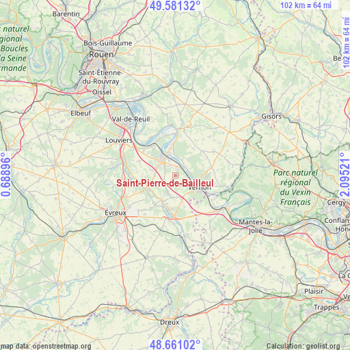
Saint-Pierre-de-Bailleul GPS coordinates[2]
49° 7' 23.88" North, 1° 23' 31.524" East
| Map corner | latitude | longitude |
|---|---|---|
| Upper-left | 49.58132°, | 0.68896° |
| Center: | 49.1233°, | 1.39209° |
| Lower-right: | 48.66102°, | 2.09521° |
| Map W x H: | 102.3×102.3 km | = 63.6×63.6mi |
| max Lat: | 51.07786° ⇑17.3% North |
| Saint-Pierre-de-Bailleul: | 49.1233° |
| min Lat: | ⇓82.7% South 41.3874° |
| min Long | Saint-Pierre-de | max Long |
| -5.08615° | 1.39209° | 9.52242° |
| W 35.6%⇐ | ⇒64.4% E |
Elevation
Elevation of Saint-Pierre-de-Bailleul is 77 m = 253 ft, and this is 116.7 m = 383 ft below average elevation for this country.
| Max E: |
2333 m = 7654 ft | 70.5% |
| Avg. | 193.7 m = 635 ft | |
| Saint-Pierre-de-Bailleul | 77 m = 253 ft | |
Min E: |
-1 m = -3 ft | 29.5% |
See also: France elevation on elevation.city.
Geographical zone
Saint-Pierre-de-Bailleul is located in North temperate zone (between Tropic of Cancer and the Arctic Circle). Distance of this North polar circle is 1939.2 km =1205 mi to North.| Distance of | km | miles | from Saint-Pierre-de-Bailleul |
|---|---|---|---|
| North Pole | 4545.1 | 2824.2 | to North |
| Arctic Circle | 1939.2 | 1205 | to North |
| Tropic Cancer | 2856.1 | 1774.7 | to South |
| Equator | 5462 | 3393.9 | to South |


Nearby cities:
15 places around Saint-Pierre-de-Bailleul: (largest is in red/bold)
• Aubevoye
6.7 km =4.2 mi,  322°
322°
• Autheuil-Authouillet
8.3 km =5.2 mi,  251°
251°
• Courcelles-sur-Seine
7 km =4.3 mi,  340°
340°
• Gaillon
5.6 km =3.5 mi, 318°
• Hennezis
9.4 km =5.8 mi,  34°
34°
• Houlbec-Cocherel
5.9 km =3.7 mi,  199°
199°
• La Chapelle-Réanville
3 km =1.9 mi,  194°
194°
• Port-Mort
4.9 km =3 mi,  19°
19°
• Pressagny-le-Val
5.8 km =3.6 mi,  40°
40°
• Saint-Aubin-sur-Gaillon
5.3 km =3.3 mi,  299°
299°
• Saint-Just
3.9 km =2.4 mi,  114°
114°
• Saint-Marcel
4.9 km =3 mi,  121°
121°
• Saint-Pierre-la-Garenne
2.6 km =1.6 mi,  6°
6°
• Vernon
6.2 km =3.9 mi, 123°
• Écardenville-sur-Eure
9.2 km =5.7 mi, 254°
Sources, notices
• [Note1] Compared only with cities in France existing in our database
• [Src1] Map data: © OpenStreetMap contributors (CC-BY-SA)
• [Src2] Other city data from geonames.org with taken over terms of usage.
• [Src3] Geographical zone / Annual Mean Temperature by Robert A. Rohde @ Wikipedia
