Saint-Aubin-sur-Gaillon geodata
Saint-Aubin-sur-Gaillon (Normandy) is a populated place; located in France in Europe/Paris (GMT+2) time zone. With population of 1,492 people, there are 6219 cities with bigger population in this country. Compared to other cities in France, 83.3% of cities are located further ↓South; 65.2% of cities are located further →East and 52.3% of cities have higher elevation than Saint-Aubin-sur-Gaillon. Note1
Administrative division(s):
- Level 1: Normandy
- Level 2: Département de l'Eure
- Level 3: Les Andelys
- Level 4: Saint-Aubin-sur-Gaillon
Current local time in Saint-Aubin-sur-Gaillon:
03:12 PM, WednesdayDifference from your time zone: hours


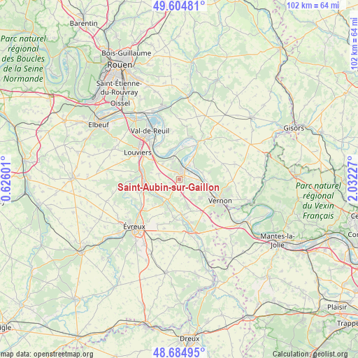
Saint-Aubin-sur-Gaillon GPS coordinates[2]
49° 8' 49.236" North, 1° 19' 44.904" East
| Map corner | latitude | longitude |
|---|---|---|
| Upper-left | 49.60481°, | 0.62601° |
| Center: | 49.14701°, | 1.32914° |
| Lower-right: | 48.68495°, | 2.03227° |
| Map W x H: | 102.3×102.3 km | = 63.6×63.6mi |
| max Lat: | 51.07786° ⇑16.7% North |
| Saint-Aubin-sur-Gaillon: | 49.14701° |
| min Lat: | ⇓83.3% South 41.3874° |
| min Long | Saint-Aubin-sur | max Long |
| -5.08615° | 1.32914° | 9.52242° |
| W 34.8%⇐ | ⇒65.2% E |
Elevation
Elevation of Saint-Aubin-sur-Gaillon is 124 m = 407 ft, and this is 69.7 m = 229 ft below average elevation for this country.
| Max E: |
2333 m = 7654 ft | 52.3% |
| Avg. | 193.7 m = 635 ft | |
| Saint-Aubin-sur-Gaillon | 124 m = 407 ft | |
Min E: |
-1 m = -3 ft | 47.7% |
See also: France elevation on elevation.city.
Geographical zone
Saint-Aubin-sur-Gaillon is located in North temperate zone (between Tropic of Cancer and the Arctic Circle). Distance of this North polar circle is 1936.5 km =1203.3 mi to North.| Distance of | km | miles | from Saint-Aubin-sur-Gaillon |
|---|---|---|---|
| North Pole | 4542.4 | 2822.5 | to North |
| Arctic Circle | 1936.5 | 1203.3 | to North |
| Tropic Cancer | 2858.7 | 1776.3 | to South |
| Equator | 5464.6 | 3395.5 | to South |


Nearby cities:
15 places around Saint-Aubin-sur-Gaillon: (largest is in red/bold)
• Aubevoye
2.7 km =1.7 mi,  9°
9°
• Autheuil-Authouillet
6.2 km =3.9 mi,  212°
212°
• Bouafles
8.5 km =5.3 mi,  30°
30°
• Courcelles-sur-Seine
4.6 km =2.9 mi, 29°
• Fontaine-Bellenger
6.6 km =4.1 mi,  311°
311°
• Gaillon
1.8 km =1.1 mi, 27°
• Heudebouville
8.4 km =5.2 mi, 309°
• La Chapelle-Réanville
6.7 km =4.2 mi,  145°
145°
• La Croix-Saint-Leufroy
7.5 km =4.7 mi,  236°
236°
• Port-Mort
6.6 km =4.1 mi,  72°
72°
• Saint-Pierre-de-Bailleul
5.3 km =3.3 mi,  119°
119°
• Saint-Pierre-la-Garenne
4.9 km =3 mi,  90°
90°
• Venables
6.3 km =3.9 mi,  336°
336°
• Villers-sur-le-Roule
5.5 km =3.4 mi,  357°
357°
• Écardenville-sur-Eure
6.7 km =4.2 mi,  220°
220°
Sources, notices
• [Note1] Compared only with cities in France existing in our database
• [Src1] Map data: © OpenStreetMap contributors (CC-BY-SA)
• [Src2] Other city data from geonames.org with taken over terms of usage.
• [Src3] Geographical zone / Annual Mean Temperature by Robert A. Rohde @ Wikipedia
