Saint-Père-sur-Loire geodata
Saint-Père-sur-Loire (Centre) is a populated place; located in France in Europe/Paris (GMT+2) time zone. With population of 1,062 people, there are 8387 cities with bigger population in this country. Compared to other cities in France, 55.3% of cities are located further ↓South; 51.5% of cities are located further →East and 57.9% of cities have higher elevation than Saint-Père-sur-Loire. Note1
Administrative division(s):
- Level 1: Centre
- Level 2: Loiret
- Level 3: Arrondissement d’Orléans
- Level 4: Saint-Père-sur-Loire


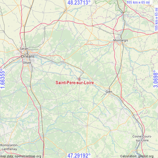
Saint-Père-sur-Loire GPS coordinates[2]
47° 46' 0.012" North, 2° 22' 0.012" East
| Map corner | latitude | longitude |
|---|---|---|
| Upper-left | 48.23713°, | 1.66355° |
| Center: | 47.76667°, | 2.36667° |
| Lower-right: | 47.29192°, | 3.0698° |
| Map W x H: | 105.1×105.1 km | = 65.3×65.3mi |
| max Lat: | 51.07786° ⇑44.7% North |
| Saint-Père-sur-Loire: | 47.76667° |
| min Lat: | ⇓55.3% South 41.3874° |
| min Long | Saint-Père-sur | max Long |
| -5.08615° | 2.36667° | 9.52242° |
| W 48.5%⇐ | ⇒51.5% E |
Elevation
Elevation of Saint-Père-sur-Loire is 108 m = 354 ft, and this is 85.7 m = 281 ft below average elevation for this country.
| Max E: |
2333 m = 7654 ft | 57.9% |
| Avg. | 193.7 m = 635 ft | |
| Saint-Père-sur-Loire | 108 m = 354 ft | |
Min E: |
-1 m = -3 ft | 42.1% |
See also: France elevation on elevation.city.
Geographical zone
Saint-Père-sur-Loire is located in North temperate zone (between Tropic of Cancer and the Arctic Circle). Distance of this North polar circle is 2090 km =1298.7 mi to North.| Distance of | km | miles | from Saint-Père-sur-Loire |
|---|---|---|---|
| North Pole | 4695.9 | 2917.9 | to North |
| Arctic Circle | 2090 | 1298.7 | to North |
| Tropic Cancer | 2705.2 | 1680.9 | to South |
| Equator | 5311.2 | 3300.2 | to South |


Nearby cities:
15 places around Saint-Père-sur-Loire: (largest is in red/bold)
• Bonnée
3.5 km =2.2 mi,  21°
21°
• Bouzy-la-Forêt
9.4 km =5.8 mi,  5°
5°
• Bray-en-Val
6.9 km =4.3 mi,  359°
359°
• Dampierre-en-Burly
11.4 km =7.1 mi,  92°
92°
• Germigny-des-Prés
11.3 km =7 mi,  320°
320°
• Guilly
8 km =5 mi,  301°
301°
• Neuvy-en-Sullias
9.7 km =6 mi,  288°
288°
• Ouzouer-sur-Loire
8.5 km =5.3 mi, 90°
• Saint-Aignan-le-Jaillard
5.9 km =3.7 mi,  116°
116°
• Saint-Benoît-sur-Loire
5.9 km =3.7 mi, 317°
• Sigloy
12.9 km =8 mi,  305°
305°
• Sully-sur-Loire
0.5 km =0.3 mi,  127°
127°
• Vannes-sur-Cosson
13 km =8.1 mi,  242°
242°
• Viglain
6.4 km =4 mi,  228°
228°
• Villemurlin
9.3 km =5.8 mi,  194°
194°
Sources, notices
• [Note1] Compared only with cities in France existing in our database
• [Src1] Map data: © OpenStreetMap contributors (CC-BY-SA)
• [Src2] Other city data from geonames.org with taken over terms of usage.
• [Src3] Geographical zone / Annual Mean Temperature by Robert A. Rohde @ Wikipedia
