Saint-Paul-sur-Isère geodata
Saint-Paul-sur-Isère (Auvergne-Rhône-Alpes) is a populated place; located in France in Europe/Paris (GMT+2) time zone. With population of 617 people, there are 13032 cities with bigger population in this country. Compared to other cities in France, 72.6% of cities are located further ↑North; 91.3% of cities are located further ←West and 89.8% of cities have lower elevation than Saint-Paul-sur-Isère. Note1
Administrative division(s):
- Level 1: Auvergne-Rhône-Alpes
- Level 2: Savoie
- Level 3: Albertville
- Level 4: Saint-Paul-sur-Isère
Current local time in Saint-Paul-sur-Isère:
01:37 PM, WednesdayDifference from your time zone: hours


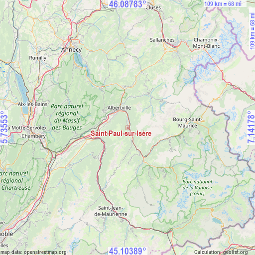
Saint-Paul-sur-Isère GPS coordinates[2]
45° 35' 52.872" North, 6° 26' 19.14" East
| Map corner | latitude | longitude |
|---|---|---|
| Upper-left | 46.08783°, | 5.73553° |
| Center: | 45.59802°, | 6.43865° |
| Lower-right: | 45.10389°, | 7.14178° |
| Map W x H: | 109.4×109.4 km | = 68×68mi |
| max Lat: | 51.07786° ⇑72.6% North |
| Saint-Paul-sur-Isère: | 45.59802° |
| min Lat: | ⇓27.4% South 41.3874° |
| min Long | Saint-Paul-sur- | max Long |
| -5.08615° | 6.43865° | 9.52242° |
| W 91.3%⇐ | ⇒8.7% E |
Elevation
Elevation of Saint-Paul-sur-Isère is 423 m = 1388 ft, and this is 229.3 m = 752 ft above average elevation for this country.
| Max E: |
2333 m = 7654 ft | 10.2% |
| Saint-Paul-sur-Isère | 423 m 1388 ft | |
| Avg. | 193.7 m = 635 ft | |
Min E: |
-1 m = -3 ft | 89.8% |
See also: France elevation on elevation.city.
Geographical zone
Saint-Paul-sur-Isère is located in North temperate zone (between Tropic of Cancer and the Arctic Circle). Distance of this North polar circle is 2331.1 km =1448.5 mi to North.| Distance of | km | miles | from Saint-Paul-sur-Isère |
|---|---|---|---|
| North Pole | 4937 | 3067.7 | to North |
| Arctic Circle | 2331.1 | 1448.5 | to North |
| Tropic Cancer | 2464.1 | 1531.1 | to South |
| Equator | 5070 | 3150.4 | to South |


Nearby cities:
15 places around Saint-Paul-sur-Isère: (largest is in red/bold)
• Albertville
9.3 km =5.8 mi,  336°
336°
• Cevins
1.4 km =0.9 mi,  121°
121°
• Esserts-Blay
1.8 km =1.1 mi,  354°
354°
• Feissons-sur-Isère
4.9 km =3 mi,  149°
149°
• Frontenex
10.6 km =6.6 mi,  291°
291°
• Gilly-sur-Isère
9.6 km =6 mi,  314°
314°
• Grignon
7.6 km =4.7 mi,  321°
321°
• La Bâthie
3.5 km =2.2 mi,  13°
13°
• Notre-Dame-des-Millières
8.3 km =5.2 mi, 289°
• Pallud
10.3 km =6.4 mi, 338°
• Saint-Vital
11.3 km =7 mi, 287°
• Sainte-Hélène-sur-Isère
9.4 km =5.8 mi,  281°
281°
• Tours-en-Savoie
6.2 km =3.9 mi,  1°
1°
• Venthon
10.1 km =6.3 mi, 347°
• Verrens
11.3 km =7 mi,  304°
304°
Sources, notices
• [Note1] Compared only with cities in France existing in our database
• [Src1] Map data: © OpenStreetMap contributors (CC-BY-SA)
• [Src2] Other city data from geonames.org with taken over terms of usage.
• [Src3] Geographical zone / Annual Mean Temperature by Robert A. Rohde @ Wikipedia
