Saint-Nexans geodata
Saint-Nexans (Nouvelle-Aquitaine) is a populated place; located in France in Europe/Paris (GMT+2) time zone. With population of 852 people, there are 10061 cities with bigger population in this country. Compared to other cities in France, 81.4% of cities are located further ↑North; 72.9% of cities are located further →East and 67.8% of cities have higher elevation than Saint-Nexans. Note1
Administrative division(s):
- Level 1: Nouvelle-Aquitaine
- Level 2: Dordogne
- Level 3: Arrondissement de Bergerac
- Level 4: Saint-Nexans


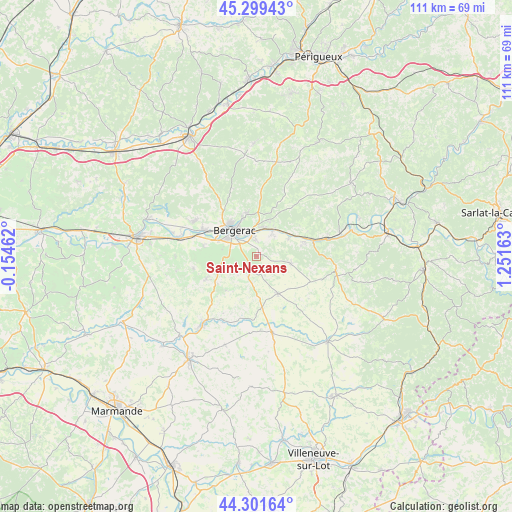
Saint-Nexans GPS coordinates[2]
44° 48' 9.684" North, 0° 32' 54.636" East
| Map corner | latitude | longitude |
|---|---|---|
| Upper-left | 45.29943°, | -0.15462° |
| Center: | 44.80269°, | 0.54851° |
| Lower-right: | 44.30164°, | 1.25163° |
| Map W x H: | 110.9×110.9 km | = 68.9×68.9mi |
| max Lat: | 51.07786° ⇑81.4% North |
| Saint-Nexans: | 44.80269° |
| min Lat: | ⇓18.6% South 41.3874° |
| min Long | Saint-Nexans | max Long |
| -5.08615° | 0.54851° | 9.52242° |
| W 27.1%⇐ | ⇒72.9% E |
Elevation
Elevation of Saint-Nexans is 83 m = 272 ft, and this is 110.7 m = 363 ft below average elevation for this country.
| Max E: |
2333 m = 7654 ft | 67.8% |
| Avg. | 193.7 m = 635 ft | |
| Saint-Nexans | 83 m = 272 ft | |
Min E: |
-1 m = -3 ft | 32.2% |
See also: France elevation on elevation.city.
Geographical zone
Saint-Nexans is located in North temperate zone (between Tropic of Cancer and the Arctic Circle). Distance of this Northern Tropic circle is 2375.7 km =1476.2 mi to South.| Distance of | km | miles | from Saint-Nexans |
|---|---|---|---|
| North Pole | 5025.5 | 3122.7 | to North |
| Arctic Circle | 2419.6 | 1503.5 | to North |
| Tropic Cancer | 2375.7 | 1476.2 | to South |
| Equator | 4981.6 | 3095.4 | to South |


Nearby cities:
15 places around Saint-Nexans: (largest is in red/bold)
• Bergerac
7.5 km =4.7 mi,  315°
315°
• Bouniagues
5.2 km =3.2 mi,  199°
199°
• Cours-de-Pile
3.7 km =2.3 mi,  357°
357°
• Creysse
5.9 km =3.7 mi,  13°
13°
• Issigeac
9.4 km =5.8 mi,  150°
150°
• Lamonzie-Montastruc
10.9 km =6.8 mi,  18°
18°
• Lanquais
9.9 km =6.2 mi,  76°
76°
• Lembras
9.2 km =5.7 mi,  349°
349°
• Monbazillac
4.5 km =2.8 mi,  257°
257°
• Mouleydier
7.1 km =4.4 mi,  33°
33°
• Pomport
10.6 km =6.6 mi, 255°
• Queyssac
11.7 km =7.3 mi, 359°
• Saint-Capraise-de-Lalinde
9.4 km =5.8 mi,  62°
62°
• Saint-Laurent-des-Vignes
7.6 km =4.7 mi,  281°
281°
• Saint-Sauveur
7.9 km =4.9 mi, 22°
Sources, notices
• [Note1] Compared only with cities in France existing in our database
• [Src1] Map data: © OpenStreetMap contributors (CC-BY-SA)
• [Src2] Other city data from geonames.org with taken over terms of usage.
• [Src3] Geographical zone / Annual Mean Temperature by Robert A. Rohde @ Wikipedia
