Lamonzie-Montastruc geodata
Lamonzie-Montastruc (Nouvelle-Aquitaine) is a populated place; located in France in Europe/Paris (GMT+2) time zone. With population of 563 people, there are 13957 cities with bigger population in this country. Compared to other cities in France, 80.5% of cities are located further ↑North; 72.4% of cities are located further →East and 75% of cities have higher elevation than Lamonzie-Montastruc. Note1
Administrative division(s):
- Level 1: Nouvelle-Aquitaine
- Level 2: Dordogne
- Level 3: Arrondissement de Bergerac
- Level 4: Lamonzie-Montastruc


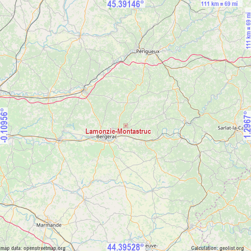
Lamonzie-Montastruc GPS coordinates[2]
44° 53' 43.908" North, 0° 35' 36.852" East
| Map corner | latitude | longitude |
|---|---|---|
| Upper-left | 45.39146°, | -0.10956° |
| Center: | 44.89553°, | 0.59357° |
| Lower-right: | 44.39528°, | 1.2967° |
| Map W x H: | 110.8×110.8 km | = 68.8×68.8mi |
| max Lat: | 51.07786° ⇑80.5% North |
| Lamonzie-Montastruc: | 44.89553° |
| min Lat: | ⇓19.5% South 41.3874° |
| min Long | Lamonzie-Montas | max Long |
| -5.08615° | 0.59357° | 9.52242° |
| W 27.6%⇐ | ⇒72.4% E |
Elevation
Elevation of Lamonzie-Montastruc is 67 m = 220 ft, and this is 126.7 m = 416 ft below average elevation for this country.
| Max E: |
2333 m = 7654 ft | 75% |
| Avg. | 193.7 m = 635 ft | |
| Lamonzie-Montastruc | 67 m = 220 ft | |
Min E: |
-1 m = -3 ft | 25% |
See also: France elevation on elevation.city.
Geographical zone
Lamonzie-Montastruc is located in North temperate zone (between Tropic of Cancer and the Arctic Circle). Distance of this Northern Tropic circle is 2386 km =1482.6 mi to South.| Distance of | km | miles | from Lamonzie-Montastruc |
|---|---|---|---|
| North Pole | 5015.1 | 3116.2 | to North |
| Arctic Circle | 2409.3 | 1497.1 | to North |
| Tropic Cancer | 2386 | 1482.6 | to South |
| Equator | 4991.9 | 3101.8 | to South |


Nearby cities:
15 places around Lamonzie-Montastruc: (largest is in red/bold)
• Bergerac
10.1 km =6.3 mi,  240°
240°
• Cours-de-Pile
7.6 km =4.7 mi,  209°
209°
• Couze-et-Saint-Front
11.5 km =7.1 mi,  130°
130°
• Creysse
5 km =3.1 mi, 205°
• Ginestet
13.1 km =8.1 mi,  276°
276°
• Lalinde
12.7 km =7.9 mi,  121°
121°
• Lanquais
10.1 km =6.3 mi,  143°
143°
• Lembras
5.4 km =3.4 mi,  256°
256°
• Maurens
9.7 km =6 mi,  296°
296°
• Monbazillac
13.8 km =8.6 mi,  215°
215°
• Mouleydier
4.4 km =2.7 mi,  175°
175°
• Queyssac
3.9 km =2.4 mi,  291°
291°
• Saint-Capraise-de-Lalinde
7.6 km =4.7 mi, 141°
• Saint-Nexans
10.9 km =6.8 mi,  198°
198°
• Saint-Sauveur
3.1 km =1.9 mi,  190°
190°
Sources, notices
• [Note1] Compared only with cities in France existing in our database
• [Src1] Map data: © OpenStreetMap contributors (CC-BY-SA)
• [Src2] Other city data from geonames.org with taken over terms of usage.
• [Src3] Geographical zone / Annual Mean Temperature by Robert A. Rohde @ Wikipedia
