Saint-Nauphary geodata
Saint-Nauphary (Occitanie) is a populated place; located in France in Europe/Paris (GMT+2) time zone. With population of 1,314 people, there are 6959 cities with bigger population in this country. Compared to other cities in France, 87.4% of cities are located further ↑North; 64% of cities are located further →East and 59.7% of cities have higher elevation than Saint-Nauphary. Note1
Administrative division(s):
- Level 1: Occitanie
- Level 2: Département du Tarn-et-Garonne
- Level 3: Arrondissement de Montauban
- Level 4: Saint-Nauphary


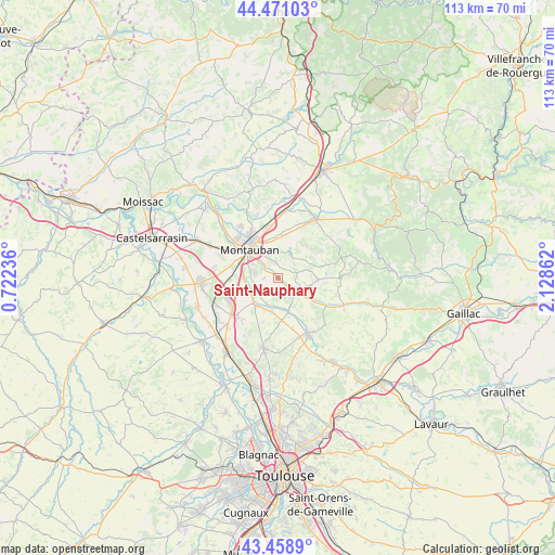
Saint-Nauphary GPS coordinates[2]
43° 58' 1.632" North, 1° 25' 31.764" East
| Map corner | latitude | longitude |
|---|---|---|
| Upper-left | 44.47103°, | 0.72236° |
| Center: | 43.96712°, | 1.42549° |
| Lower-right: | 43.4589°, | 2.12862° |
| Map W x H: | 112.5×112.5 km | = 69.9×69.9mi |
| max Lat: | 51.07786° ⇑87.4% North |
| Saint-Nauphary: | 43.96712° |
| min Lat: | ⇓12.6% South 41.3874° |
| min Long | Saint-Nauphary | max Long |
| -5.08615° | 1.42549° | 9.52242° |
| W 36%⇐ | ⇒64% E |
Elevation
Elevation of Saint-Nauphary is 103 m = 338 ft, and this is 90.7 m = 298 ft below average elevation for this country.
| Max E: |
2333 m = 7654 ft | 59.7% |
| Avg. | 193.7 m = 635 ft | |
| Saint-Nauphary | 103 m = 338 ft | |
Min E: |
-1 m = -3 ft | 40.3% |
See also: France elevation on elevation.city.
Geographical zone
Saint-Nauphary is located in North temperate zone (between Tropic of Cancer and the Arctic Circle). Distance of this Northern Tropic circle is 2282.8 km =1418.5 mi to South.| Distance of | km | miles | from Saint-Nauphary |
|---|---|---|---|
| North Pole | 5118.4 | 3180.4 | to North |
| Arctic Circle | 2512.5 | 1561.2 | to North |
| Tropic Cancer | 2282.8 | 1418.5 | to South |
| Equator | 4888.7 | 3037.7 | to South |


Nearby cities:
15 places around Saint-Nauphary: (largest is in red/bold)
• Bressols
7 km =4.3 mi,  270°
270°
• Campsas
11.2 km =7 mi,  224°
224°
• Corbarieu
5.2 km =3.2 mi,  240°
240°
• La Salvetat-Belmontet
8.6 km =5.3 mi,  92°
92°
• Labastide-Saint-Pierre
7.3 km =4.5 mi, 220°
• Léojac
5.8 km =3.6 mi,  19°
19°
• Monclar-de-Quercy
12.8 km =8 mi, 90°
• Montauban
7.5 km =4.7 mi,  319°
319°
• Montbeton
11.5 km =7.1 mi,  298°
298°
• Nohic
8.7 km =5.4 mi,  173°
173°
• Orgueil
6.9 km =4.3 mi,  189°
189°
• Reyniès
6 km =3.7 mi,  200°
200°
• Saint-Etienne-de-Tulmont
9.8 km =6.1 mi, 19°
• Villebrumier
7 km =4.3 mi,  159°
159°
• Villemur-sur-Tarn
12.7 km =7.9 mi,  150°
150°
Sources, notices
• [Note1] Compared only with cities in France existing in our database
• [Src1] Map data: © OpenStreetMap contributors (CC-BY-SA)
• [Src2] Other city data from geonames.org with taken over terms of usage.
• [Src3] Geographical zone / Annual Mean Temperature by Robert A. Rohde @ Wikipedia
