Labastide-Saint-Pierre geodata
Labastide-Saint-Pierre (Occitanie) is a populated place; located in France in Europe/Paris (GMT+2) time zone. With population of 3,253 people, there are 3002 cities with bigger population in this country. Compared to other cities in France, 87.9% of cities are located further ↑North; 64.8% of cities are located further →East and 60% of cities have higher elevation than Labastide-Saint-Pierre. Note1
Administrative division(s):
- Level 1: Occitanie
- Level 2: Département du Tarn-et-Garonne
- Level 3: Arrondissement de Montauban
- Level 4: Labastide-Saint-Pierre
Current local time in Labastide-Saint-Pierre:
04:23 AM, WednesdayDifference from your time zone: hours


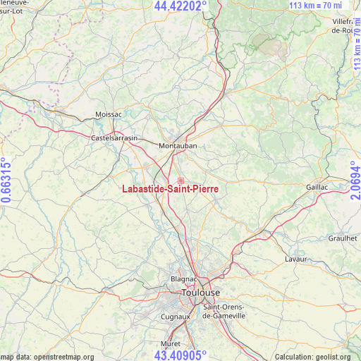
Labastide-Saint-Pierre GPS coordinates[2]
43° 55' 3.684" North, 1° 21' 58.608" East
| Map corner | latitude | longitude |
|---|---|---|
| Upper-left | 44.42202°, | 0.66315° |
| Center: | 43.91769°, | 1.36628° |
| Lower-right: | 43.40905°, | 2.0694° |
| Map W x H: | 112.6×112.6 km | = 70×70mi |
| max Lat: | 51.07786° ⇑87.9% North |
| Labastide-Saint-Pierre: | 43.91769° |
| min Lat: | ⇓12.1% South 41.3874° |
| min Long | Labastide-Saint | max Long |
| -5.08615° | 1.36628° | 9.52242° |
| W 35.2%⇐ | ⇒64.8% E |
Elevation
Elevation of Labastide-Saint-Pierre is 102 m = 335 ft, and this is 91.7 m = 301 ft below average elevation for this country.
| Max E: |
2333 m = 7654 ft | 60% |
| Avg. | 193.7 m = 635 ft | |
| Labastide-Saint-Pierre | 102 m = 335 ft | |
Min E: |
-1 m = -3 ft | 40% |
See also: France elevation on elevation.city.
Geographical zone
Labastide-Saint-Pierre is located in North temperate zone (between Tropic of Cancer and the Arctic Circle). Distance of this Northern Tropic circle is 2277.3 km =1415 mi to South.| Distance of | km | miles | from Labastide-Saint-Pierre |
|---|---|---|---|
| North Pole | 5123.9 | 3183.8 | to North |
| Arctic Circle | 2518 | 1564.6 | to North |
| Tropic Cancer | 2277.3 | 1415 | to South |
| Equator | 4883.2 | 3034.3 | to South |


Nearby cities:
15 places around Labastide-Saint-Pierre: (largest is in red/bold)
• Bessens
10 km =6.2 mi,  244°
244°
• Bressols
6 km =3.7 mi,  338°
338°
• Campsas
4 km =2.5 mi,  232°
232°
• Canals
9.5 km =5.9 mi,  219°
219°
• Corbarieu
2.9 km =1.8 mi,  3°
3°
• Dieupentale
9.9 km =6.2 mi, 231°
• Fronton
8.9 km =5.5 mi,  168°
168°
• Lacourt-Saint-Pierre
11.1 km =6.9 mi,  312°
312°
• Montbartier
7.4 km =4.6 mi,  266°
266°
• Nohic
6.5 km =4 mi,  118°
118°
• Orgueil
3.8 km =2.4 mi,  109°
109°
• Reyniès
2.6 km =1.6 mi,  92°
92°
• Saint-Nauphary
7.3 km =4.5 mi,  40°
40°
• Villaudric
11 km =6.8 mi,  151°
151°
• Villebrumier
7.3 km =4.5 mi,  98°
98°
Sources, notices
• [Note1] Compared only with cities in France existing in our database
• [Src1] Map data: © OpenStreetMap contributors (CC-BY-SA)
• [Src2] Other city data from geonames.org with taken over terms of usage.
• [Src3] Geographical zone / Annual Mean Temperature by Robert A. Rohde @ Wikipedia
