Saint-Nabor geodata
Saint-Nabor (Grand Est) is a populated place; located in France in Europe/Paris (GMT+2) time zone. With population of 520 people, there are 14814 cities with bigger population in this country. Compared to other cities in France, 67.2% of cities are located further ↓South; 97.4% of cities are located further ←West and 84% of cities have lower elevation than Saint-Nabor. Note1
Administrative division(s):
- Level 1: Grand Est
- Level 2: Bas-Rhin
- Level 3: Arrondissement de Molsheim
- Level 4: Saint-Nabor


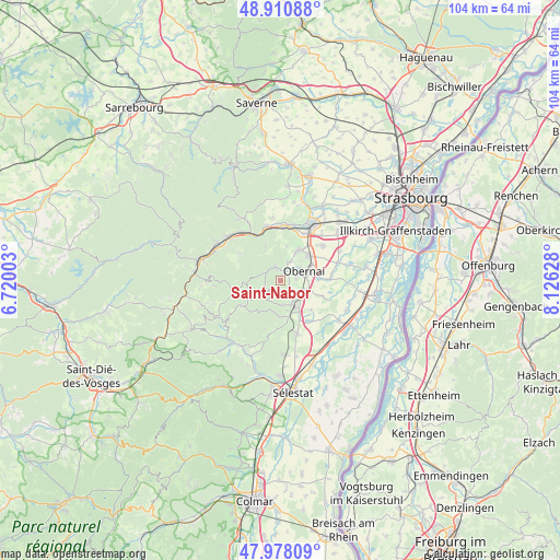
Saint-Nabor GPS coordinates[2]
48° 26' 47.868" North, 7° 25' 23.34" East
| Map corner | latitude | longitude |
|---|---|---|
| Upper-left | 48.91088°, | 6.72003° |
| Center: | 48.44663°, | 7.42315° |
| Lower-right: | 47.97809°, | 8.12628° |
| Map W x H: | 103.7×103.7 km | = 64.4×64.4mi |
| max Lat: | 51.07786° ⇑32.8% North |
| Saint-Nabor: | 48.44663° |
| min Lat: | ⇓67.2% South 41.3874° |
| min Long | Saint-Nabor | max Long |
| -5.08615° | 7.42315° | 9.52242° |
| W 97.4%⇐ | ⇒2.6% E |
Elevation
Elevation of Saint-Nabor is 334 m = 1096 ft, and this is 140.3 m = 460 ft above average elevation for this country.
| Max E: |
2333 m = 7654 ft | 16% |
| Saint-Nabor | 334 m 1096 ft | |
| Avg. | 193.7 m = 635 ft | |
Min E: |
-1 m = -3 ft | 84% |
See also: France elevation on elevation.city.
Geographical zone
Saint-Nabor is located in North temperate zone (between Tropic of Cancer and the Arctic Circle). Distance of this North polar circle is 2014.4 km =1251.7 mi to North.| Distance of | km | miles | from Saint-Nabor |
|---|---|---|---|
| North Pole | 4620.3 | 2870.9 | to North |
| Arctic Circle | 2014.4 | 1251.7 | to North |
| Tropic Cancer | 2780.8 | 1727.9 | to South |
| Equator | 5386.8 | 3347.2 | to South |


Nearby cities:
15 places around Saint-Nabor: (largest is in red/bold)
• Andlau
6.7 km =4.2 mi,  183°
183°
• Barr
4.7 km =2.9 mi,  156°
156°
• Bernardswiller
2.9 km =1.8 mi,  81°
81°
• Bischoffsheim
6.7 km =4.2 mi,  47°
47°
• Bœrsch
3.6 km =2.2 mi,  20°
20°
• Gertwiller
5.2 km =3.2 mi,  140°
140°
• Goxwiller
4.8 km =3 mi,  109°
109°
• Heiligenstein
3.3 km =2.1 mi, 143°
• Mittelbergheim
5.8 km =3.6 mi,  166°
166°
• Mollkirch
7.2 km =4.5 mi,  337°
337°
• Niedernai
6.9 km =4.3 mi,  85°
85°
• Obernai
4.6 km =2.9 mi,  66°
66°
• Ottrott
1.1 km =0.7 mi,  9°
9°
• Rosenwiller
6.6 km =4.1 mi, 9°
• Rosheim
6.6 km =4.1 mi,  32°
32°
Sources, notices
• [Note1] Compared only with cities in France existing in our database
• [Src1] Map data: © OpenStreetMap contributors (CC-BY-SA)
• [Src2] Other city data from geonames.org with taken over terms of usage.
• [Src3] Geographical zone / Annual Mean Temperature by Robert A. Rohde @ Wikipedia
