Bœrsch geodata
Bœrsch (Grand Est) is a populated place; located in France in Europe/Paris (GMT+2) time zone. With population of 2,256 people, there are 4271 cities with bigger population in this country. Compared to other cities in France, 67.8% of cities are located further ↓South; 97.5% of cities are located further ←West and 73% of cities have lower elevation than Bœrsch. Note1
Administrative division(s):
- Level 1: Grand Est
- Level 2: Bas-Rhin
- Level 3: Arrondissement de Molsheim
- Level 4: Bœrsch


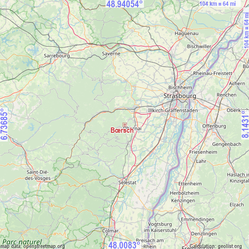
Bœrsch GPS coordinates[2]
48° 28' 35.616" North, 7° 26' 23.928" East
| Map corner | latitude | longitude |
|---|---|---|
| Upper-left | 48.94054°, | 6.73685° |
| Center: | 48.47656°, | 7.43998° |
| Lower-right: | 48.0083°, | 8.1431° |
| Map W x H: | 103.7×103.7 km | = 64.4×64.4mi |
| max Lat: | 51.07786° ⇑32.2% North |
| Bœrsch: | 48.47656° |
| min Lat: | ⇓67.8% South 41.3874° |
| min Long | Bœrsch | max Long |
| -5.08615° | 7.43998° | 9.52242° |
| W 97.5%⇐ | ⇒2.5% E |
Elevation
Elevation of Bœrsch is 236 m = 774 ft, and this is 42.3 m = 139 ft above average elevation for this country.
| Max E: |
2333 m = 7654 ft | 27% |
| Bœrsch | 236 m 774 ft | |
| Avg. | 193.7 m = 635 ft | |
Min E: |
-1 m = -3 ft | 73% |
See also: France elevation on elevation.city.
Geographical zone
Bœrsch is located in North temperate zone (between Tropic of Cancer and the Arctic Circle). Distance of this North polar circle is 2011.1 km =1249.6 mi to North.| Distance of | km | miles | from Bœrsch |
|---|---|---|---|
| North Pole | 4617 | 2868.9 | to North |
| Arctic Circle | 2011.1 | 1249.6 | to North |
| Tropic Cancer | 2784.2 | 1730 | to South |
| Equator | 5390.1 | 3349.3 | to South |


Nearby cities:
15 places around Bœrsch: (largest is in red/bold)
• Bernardswiller
3.3 km =2.1 mi,  150°
150°
• Bischoffsheim
3.8 km =2.4 mi,  72°
72°
• Dorlisheim
6.4 km =4 mi,  32°
32°
• Goxwiller
6 km =3.7 mi, 146°
• Gresswiller
6.6 km =4.1 mi,  355°
355°
• Griesheim-près-Molsheim
7.3 km =4.5 mi, 66°
• Heiligenstein
6.1 km =3.8 mi,  173°
173°
• Mollkirch
5.2 km =3.2 mi,  309°
309°
• Mutzig
7.1 km =4.4 mi,  9°
9°
• Niedernai
6.3 km =3.9 mi,  116°
116°
• Obernai
3.4 km =2.1 mi, 116°
• Ottrott
2.5 km =1.6 mi,  205°
205°
• Rosenwiller
3.2 km =2 mi, 358°
• Rosheim
3.2 km =2 mi,  45°
45°
• Saint-Nabor
3.6 km =2.2 mi,  200°
200°
Sources, notices
• [Note1] Compared only with cities in France existing in our database
• [Src1] Map data: © OpenStreetMap contributors (CC-BY-SA)
• [Src2] Other city data from geonames.org with taken over terms of usage.
• [Src3] Geographical zone / Annual Mean Temperature by Robert A. Rohde @ Wikipedia
