Saint-Maurice-des-Lions geodata
Saint-Maurice-des-Lions (Nouvelle-Aquitaine) is a populated place; located in France in Europe/Paris (GMT+2) time zone. With population of 959 people, there are 9134 cities with bigger population in this country. Compared to other cities in France, 66.7% of cities are located further ↑North; 71.4% of cities are located further →East and 65.4% of cities have lower elevation than Saint-Maurice-des-Lions. Note1
Administrative division(s):
- Level 1: Nouvelle-Aquitaine
- Level 2: Charente
- Level 3: Arrondissement de Confolens
- Level 4: Saint-Maurice-des-Lions
Current local time in Saint-Maurice-des-Lions:
12:00 PM, SaturdayDifference from your time zone: hours


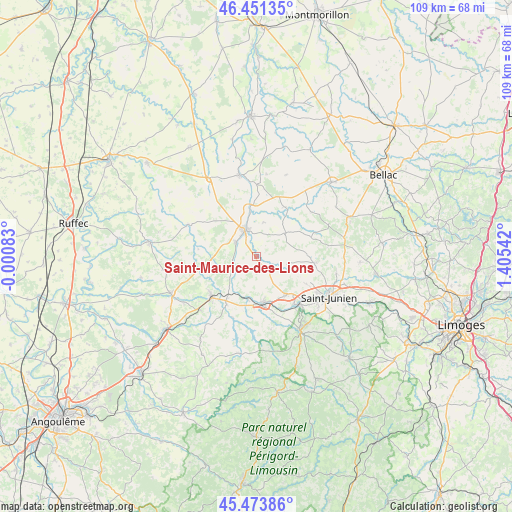
Saint-Maurice-des-Lions GPS coordinates[2]
45° 57' 53.136" North, 0° 42' 8.244" East
| Map corner | latitude | longitude |
|---|---|---|
| Upper-left | 46.45135°, | -0.00083° |
| Center: | 45.96476°, | 0.70229° |
| Lower-right: | 45.47386°, | 1.40542° |
| Map W x H: | 108.7×108.7 km | = 67.5×67.5mi |
| max Lat: | 51.07786° ⇑66.7% North |
| Saint-Maurice-des-Lions: | 45.96476° |
| min Lat: | ⇓33.3% South 41.3874° |
| min Long | Saint-Maurice-d | max Long |
| -5.08615° | 0.70229° | 9.52242° |
| W 28.6%⇐ | ⇒71.4% E |
Elevation
Elevation of Saint-Maurice-des-Lions is 196 m = 643 ft, and this is 2.3 m = 8 ft above average elevation for this country.
| Max E: |
2333 m = 7654 ft | 34.6% |
| Saint-Maurice-des-Lions | 196 m 643 ft | |
| Avg. | 193.7 m = 635 ft | |
Min E: |
-1 m = -3 ft | 65.4% |
See also: France elevation on elevation.city.
Geographical zone
Saint-Maurice-des-Lions is located in North temperate zone (between Tropic of Cancer and the Arctic Circle). Distance of this North polar circle is 2290.4 km =1423.2 mi to North.| Distance of | km | miles | from Saint-Maurice-des-Lions |
|---|---|---|---|
| North Pole | 4896.3 | 3042.4 | to North |
| Arctic Circle | 2290.4 | 1423.2 | to North |
| Tropic Cancer | 2504.9 | 1556.5 | to South |
| Equator | 5110.8 | 3175.7 | to South |


Nearby cities:
15 places around Saint-Maurice-des-Lions: (largest is in red/bold)
• Ansac-sur-Vienne
5.4 km =3.4 mi,  305°
305°
• Brigueuil
12.3 km =7.6 mi,  95°
95°
• Brillac
12.1 km =7.5 mi,  28°
28°
• Chabanais
10.2 km =6.3 mi,  173°
173°
• Chassenon
13.5 km =8.4 mi,  158°
158°
• Chirac
6.7 km =4.2 mi,  212°
212°
• Confolens
5.9 km =3.7 mi,  336°
336°
• Esse
7.6 km =4.7 mi,  11°
11°
• Exideuil
9 km =5.6 mi,  194°
194°
• Lessac
11.7 km =7.3 mi,  349°
349°
• Loubert
10.6 km =6.6 mi,  237°
237°
• Manot
5.6 km =3.5 mi, 244°
• Roumazières-Loubert
12.8 km =8 mi,  227°
227°
• Saillat-sur-Vienne
13.5 km =8.4 mi,  139°
139°
• Étagnac
9.8 km =6.1 mi, 142°
Sources, notices
• [Note1] Compared only with cities in France existing in our database
• [Src1] Map data: © OpenStreetMap contributors (CC-BY-SA)
• [Src2] Other city data from geonames.org with taken over terms of usage.
• [Src3] Geographical zone / Annual Mean Temperature by Robert A. Rohde @ Wikipedia
