Loubert geodata
Loubert (Nouvelle-Aquitaine) is a populated place; located in France in Europe/Paris (GMT+2) time zone. With population of 2,870 people, there are 3403 cities with bigger population in this country. Compared to other cities in France, 67.4% of cities are located further ↑North; 72.5% of cities are located further →East and 61.3% of cities have lower elevation than Loubert. Note1
Administrative division(s):
- Level 1: Nouvelle-Aquitaine
- Level 2: Charente
- Level 3: Arrondissement de Confolens
- Level 4: Terres-de-Haute-Charente


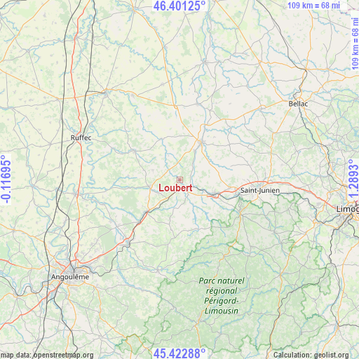
Loubert GPS coordinates[2]
45° 54' 51.192" North, 0° 35' 10.212" East
| Map corner | latitude | longitude |
|---|---|---|
| Upper-left | 46.40125°, | -0.11695° |
| Center: | 45.91422°, | 0.58617° |
| Lower-right: | 45.42288°, | 1.2893° |
| Map W x H: | 108.8×108.8 km | = 67.6×67.6mi |
| max Lat: | 51.07786° ⇑67.4% North |
| Loubert: | 45.91422° |
| min Lat: | ⇓32.6% South 41.3874° |
| min Long | Loubert | max Long |
| -5.08615° | 0.58617° | 9.52242° |
| W 27.5%⇐ | ⇒72.5% E |
Elevation
Elevation of Loubert is 176 m = 577 ft, and this is 17.7 m = 58 ft below average elevation for this country.
| Max E: |
2333 m = 7654 ft | 38.7% |
| Avg. | 193.7 m = 635 ft | |
| Loubert | 176 m = 577 ft | |
Min E: |
-1 m = -3 ft | 61.3% |
See also: France elevation on elevation.city.
Geographical zone
Loubert is located in North temperate zone (between Tropic of Cancer and the Arctic Circle). Distance of this North polar circle is 2296 km =1426.7 mi to North.| Distance of | km | miles | from Loubert |
|---|---|---|---|
| North Pole | 4901.9 | 3045.9 | to North |
| Arctic Circle | 2296 | 1426.7 | to North |
| Tropic Cancer | 2499.3 | 1553 | to South |
| Equator | 5105.2 | 3172.2 | to South |


Nearby cities:
15 places around Loubert: (largest is in red/bold)
• Alloue
14.3 km =8.9 mi,  337°
337°
• Ansac-sur-Vienne
9.9 km =6.2 mi,  27°
27°
• Chabanais
11.1 km =6.9 mi,  114°
114°
• Chirac
5.3 km =3.3 mi,  90°
90°
• Confolens
12.9 km =8 mi, 31°
• Exideuil
7.4 km =4.6 mi, 114°
• Genouillac
6.9 km =4.3 mi,  189°
189°
• Manot
5.1 km =3.2 mi,  51°
51°
• Nieuil
7.7 km =4.8 mi,  239°
239°
• Roumazières-Loubert
3.1 km =1.9 mi, 187°
• Saint-Claud
9.6 km =6 mi,  257°
257°
• Saint-Laurent-de-Céris
8.7 km =5.4 mi,  290°
290°
• Saint-Maurice-des-Lions
10.6 km =6.6 mi,  57°
57°
• Vitrac-Saint-Vincent
15 km =9.3 mi,  208°
208°
• Étagnac
15.1 km =9.4 mi,  98°
98°
Sources, notices
• [Note1] Compared only with cities in France existing in our database
• [Src1] Map data: © OpenStreetMap contributors (CC-BY-SA)
• [Src2] Other city data from geonames.org with taken over terms of usage.
• [Src3] Geographical zone / Annual Mean Temperature by Robert A. Rohde @ Wikipedia
