Chabanais geodata
Chabanais (Nouvelle-Aquitaine) is a populated place; located in France in Europe/Paris (GMT+2) time zone. With population of 1,889 people, there are 5052 cities with bigger population in this country. Compared to other cities in France, 68.1% of cities are located further ↑North; 71.3% of cities are located further →East and 56.3% of cities have lower elevation than Chabanais. Note1
Administrative division(s):
- Level 1: Nouvelle-Aquitaine
- Level 2: Charente
- Level 3: Arrondissement de Confolens
- Level 4: Chabanais


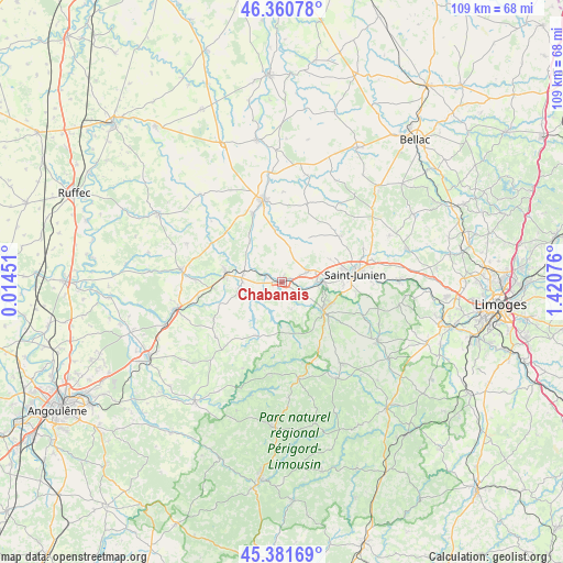
Chabanais GPS coordinates[2]
45° 52' 24.204" North, 0° 43' 3.468" East
| Map corner | latitude | longitude |
|---|---|---|
| Upper-left | 46.36078°, | 0.01451° |
| Center: | 45.87339°, | 0.71763° |
| Lower-right: | 45.38169°, | 1.42076° |
| Map W x H: | 108.9×108.9 km | = 67.7×67.7mi |
| max Lat: | 51.07786° ⇑68.1% North |
| Chabanais: | 45.87339° |
| min Lat: | ⇓31.9% South 41.3874° |
| min Long | Chabanais | max Long |
| -5.08615° | 0.71763° | 9.52242° |
| W 28.7%⇐ | ⇒71.3% E |
Elevation
Elevation of Chabanais is 155 m = 509 ft, and this is 38.7 m = 127 ft below average elevation for this country.
| Max E: |
2333 m = 7654 ft | 43.7% |
| Avg. | 193.7 m = 635 ft | |
| Chabanais | 155 m = 509 ft | |
Min E: |
-1 m = -3 ft | 56.3% |
See also: France elevation on elevation.city.
Geographical zone
Chabanais is located in North temperate zone (between Tropic of Cancer and the Arctic Circle). Distance of this North polar circle is 2300.5 km =1429.5 mi to North.| Distance of | km | miles | from Chabanais |
|---|---|---|---|
| North Pole | 4906.4 | 3048.7 | to North |
| Arctic Circle | 2300.5 | 1429.5 | to North |
| Tropic Cancer | 2494.7 | 1550.1 | to South |
| Equator | 5100.6 | 3169.4 | to South |


Nearby cities:
15 places around Chabanais: (largest is in red/bold)
• Ansac-sur-Vienne
14.4 km =8.9 mi,  337°
337°
• Brigueuil
14.2 km =8.8 mi,  51°
51°
• Chaillac-sur-Vienne
12 km =7.5 mi,  86°
86°
• Chassenon
4.4 km =2.7 mi,  123°
123°
• Chirac
6.6 km =4.1 mi,  312°
312°
• Exideuil
3.7 km =2.3 mi,  292°
292°
• Genouillac
11.6 km =7.2 mi,  258°
258°
• Loubert
11.1 km =6.9 mi, 294°
• Manot
9.9 km =6.2 mi,  321°
321°
• Rochechouart
9.7 km =6 mi, 124°
• Roumazières-Loubert
10.7 km =6.6 mi,  278°
278°
• Saillat-sur-Vienne
7.6 km =4.7 mi, 91°
• Saint-Junien
14.3 km =8.9 mi,  83°
83°
• Saint-Maurice-des-Lions
10.2 km =6.3 mi,  353°
353°
• Étagnac
5.3 km =3.3 mi,  63°
63°
Sources, notices
• [Note1] Compared only with cities in France existing in our database
• [Src1] Map data: © OpenStreetMap contributors (CC-BY-SA)
• [Src2] Other city data from geonames.org with taken over terms of usage.
• [Src3] Geographical zone / Annual Mean Temperature by Robert A. Rohde @ Wikipedia
