Esse geodata
Esse (Nouvelle-Aquitaine) is a populated place; located in France in Europe/Paris (GMT+2) time zone. With population of 512 people, there are 14990 cities with bigger population in this country. Compared to other cities in France, 65.9% of cities are located further ↑North; 71.3% of cities are located further →East and 69.8% of cities have lower elevation than Esse. Note1
Administrative division(s):
- Level 1: Nouvelle-Aquitaine
- Level 2: Charente
- Level 3: Arrondissement de Confolens
- Level 4: Esse


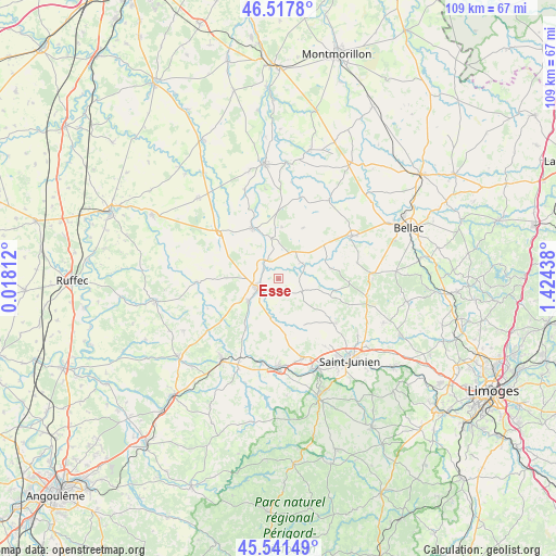
Esse GPS coordinates[2]
46° 1' 54.48" North, 0° 43' 16.5" East
| Map corner | latitude | longitude |
|---|---|---|
| Upper-left | 46.5178°, | 0.01812° |
| Center: | 46.0318°, | 0.72125° |
| Lower-right: | 45.54149°, | 1.42438° |
| Map W x H: | 108.6×108.6 km | = 67.5×67.5mi |
| max Lat: | 51.07786° ⇑65.9% North |
| Esse: | 46.0318° |
| min Lat: | ⇓34.1% South 41.3874° |
| min Long | Esse | max Long |
| -5.08615° | 0.72125° | 9.52242° |
| W 28.7%⇐ | ⇒71.3% E |
Elevation
Elevation of Esse is 218 m = 715 ft, and this is 24.3 m = 80 ft above average elevation for this country.
| Max E: |
2333 m = 7654 ft | 30.2% |
| Esse | 218 m 715 ft | |
| Avg. | 193.7 m = 635 ft | |
Min E: |
-1 m = -3 ft | 69.8% |
See also: France elevation on elevation.city.
Geographical zone
Esse is located in North temperate zone (between Tropic of Cancer and the Arctic Circle). Distance of this North polar circle is 2282.9 km =1418.5 mi to North.| Distance of | km | miles | from Esse |
|---|---|---|---|
| North Pole | 4888.8 | 3037.8 | to North |
| Arctic Circle | 2282.9 | 1418.5 | to North |
| Tropic Cancer | 2512.3 | 1561.1 | to South |
| Equator | 5118.3 | 3180.4 | to South |


Nearby cities:
15 places around Esse: (largest is in red/bold)
• Alloue
15.8 km =9.8 mi,  270°
270°
• Ansac-sur-Vienne
7.3 km =4.5 mi,  233°
233°
• Availles-Limouzine
11.2 km =7 mi,  332°
332°
• Brigueuil
13.9 km =8.6 mi,  129°
129°
• Brillac
5.4 km =3.4 mi,  53°
53°
• Chirac
14.1 km =8.8 mi,  201°
201°
• Confolens
4.3 km =2.7 mi,  241°
241°
• Exideuil
16.6 km =10.3 mi,  192°
192°
• Lessac
5.4 km =3.4 mi,  319°
319°
• Loubert
16.7 km =10.4 mi,  218°
218°
• Manot
11.8 km =7.3 mi,  213°
213°
• Nouic
15.6 km =9.7 mi,  78°
78°
• Pressac
14.9 km =9.3 mi,  308°
308°
• Saint-Maurice-des-Lions
7.6 km =4.7 mi, 191°
• Étagnac
15.8 km =9.8 mi,  163°
163°
Sources, notices
• [Note1] Compared only with cities in France existing in our database
• [Src1] Map data: © OpenStreetMap contributors (CC-BY-SA)
• [Src2] Other city data from geonames.org with taken over terms of usage.
• [Src3] Geographical zone / Annual Mean Temperature by Robert A. Rohde @ Wikipedia
