Saint-Loup-de-Naud geodata
Saint-Loup-de-Naud (Île-de-France) is a populated place; located in France in Europe/Paris (GMT+2) time zone. With population of 941 people, there are 9290 cities with bigger population in this country. Compared to other cities in France, 69.1% of cities are located further ↓South; 60.6% of cities are located further ←West and 50.9% of cities have higher elevation than Saint-Loup-de-Naud. Note1
Administrative division(s):
- Level 1: Île-de-France
- Level 2: Seine-et-Marne
- Level 3: Arrondissement de Provins
- Level 4: Saint-Loup-de-Naud


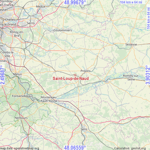
Saint-Loup-de-Naud GPS coordinates[2]
48° 31' 59.988" North, 3° 12' 0" East
| Map corner | latitude | longitude |
|---|---|---|
| Upper-left | 48.99679°, | 2.49687° |
| Center: | 48.53333°, | 3.2° |
| Lower-right: | 48.06559°, | 3.90312° |
| Map W x H: | 103.5×103.5 km | = 64.3×64.3mi |
| max Lat: | 51.07786° ⇑30.9% North |
| Saint-Loup-de-Naud: | 48.53333° |
| min Lat: | ⇓69.1% South 41.3874° |
| min Long | Saint-Loup-de-N | max Long |
| -5.08615° | 3.2° | 9.52242° |
| W 60.6%⇐ | ⇒39.4% E |
Elevation
Elevation of Saint-Loup-de-Naud is 129 m = 423 ft, and this is 64.7 m = 212 ft below average elevation for this country.
| Max E: |
2333 m = 7654 ft | 50.9% |
| Avg. | 193.7 m = 635 ft | |
| Saint-Loup-de-Naud | 129 m = 423 ft | |
Min E: |
-1 m = -3 ft | 49.1% |
See also: France elevation on elevation.city.
Geographical zone
Saint-Loup-de-Naud is located in North temperate zone (between Tropic of Cancer and the Arctic Circle). Distance of this North polar circle is 2004.8 km =1245.7 mi to North.| Distance of | km | miles | from Saint-Loup-de-Naud |
|---|---|---|---|
| North Pole | 4610.7 | 2865 | to North |
| Arctic Circle | 2004.8 | 1245.7 | to North |
| Tropic Cancer | 2790.5 | 1733.9 | to South |
| Equator | 5396.4 | 3353.2 | to South |


Nearby cities:
15 places around Saint-Loup-de-Naud: (largest is in red/bold)
• Chalautre-la-Petite
8.3 km =5.2 mi,  93°
93°
• Chalmaison
6.8 km =4.2 mi,  146°
146°
• Chenoise
9 km =5.6 mi,  357°
357°
• Donnemarie-Dontilly
8 km =5 mi,  218°
218°
• Everly
8.3 km =5.2 mi, 153°
• Gouaix
8.7 km =5.4 mi,  127°
127°
• Jutigny
4.5 km =2.8 mi, 148°
• Les Ormes-sur-Voulzie
8.1 km =5 mi,  164°
164°
• Longueville
4 km =2.5 mi,  120°
120°
• Provins
7.9 km =4.9 mi,  68°
68°
• Rampillon
10 km =6.2 mi,  280°
280°
• Saint-Brice
9.9 km =6.2 mi, 67°
• Sainte-Colombe
4.1 km =2.5 mi, 94°
• Savins
2.7 km =1.7 mi,  176°
176°
• Soisy-Bouy
7.4 km =4.6 mi,  108°
108°
Sources, notices
• [Note1] Compared only with cities in France existing in our database
• [Src1] Map data: © OpenStreetMap contributors (CC-BY-SA)
• [Src2] Other city data from geonames.org with taken over terms of usage.
• [Src3] Geographical zone / Annual Mean Temperature by Robert A. Rohde @ Wikipedia
