Everly geodata
Everly (Île-de-France) is a populated place; located in France in Europe/Paris (GMT+2) time zone. With population of 622 people, there are 12950 cities with bigger population in this country. Compared to other cities in France, 67.6% of cities are located further ↓South; 61.3% of cities are located further ←West and 76.6% of cities have higher elevation than Everly. Note1
Administrative division(s):
- Level 1: Île-de-France
- Level 2: Seine-et-Marne
- Level 3: Arrondissement de Provins
- Level 4: Everly


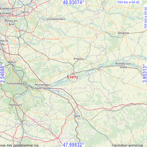
Everly GPS coordinates[2]
48° 28' 0.012" North, 3° 15' 0" East
| Map corner | latitude | longitude |
|---|---|---|
| Upper-left | 48.93074°, | 2.54688° |
| Center: | 48.46667°, | 3.25° |
| Lower-right: | 47.99832°, | 3.95313° |
| Map W x H: | 103.7×103.7 km | = 64.4×64.4mi |
| max Lat: | 51.07786° ⇑32.4% North |
| Everly: | 48.46667° |
| min Lat: | ⇓67.6% South 41.3874° |
| min Long | Everly | max Long |
| -5.08615° | 3.25° | 9.52242° |
| W 61.3%⇐ | ⇒38.7% E |
Elevation
Elevation of Everly is 63 m = 207 ft, and this is 130.7 m = 429 ft below average elevation for this country.
| Max E: |
2333 m = 7654 ft | 76.6% |
| Avg. | 193.7 m = 635 ft | |
| Everly | 63 m = 207 ft | |
Min E: |
-1 m = -3 ft | 23.4% |
See also: France elevation on elevation.city.
Geographical zone
Everly is located in North temperate zone (between Tropic of Cancer and the Arctic Circle). Distance of this North polar circle is 2012.2 km =1250.3 mi to North.| Distance of | km | miles | from Everly |
|---|---|---|---|
| North Pole | 4618.1 | 2869.6 | to North |
| Arctic Circle | 2012.2 | 1250.3 | to North |
| Tropic Cancer | 2783.1 | 1729.3 | to South |
| Equator | 5389 | 3348.6 | to South |


Nearby cities:
15 places around Everly: (largest is in red/bold)
• Bazoches-lès-Bray
8.8 km =5.5 mi,  211°
211°
• Bray-sur-Seine
5.9 km =3.7 mi,  188°
188°
• Chalautre-la-Petite
8.3 km =5.2 mi,  33°
33°
• Chalmaison
1.7 km =1.1 mi,  3°
3°
• Donnemarie-Dontilly
8.8 km =5.5 mi,  277°
277°
• Gouaix
3.8 km =2.4 mi,  56°
56°
• Hermé
7.4 km =4.6 mi,  74°
74°
• Jutigny
3.8 km =2.4 mi,  339°
339°
• Les Ormes-sur-Voulzie
1.5 km =0.9 mi,  257°
257°
• Longueville
5.4 km =3.4 mi,  357°
357°
• Mousseaux-lès-Bray
6 km =3.7 mi,  195°
195°
• Saint-Loup-de-Naud
8.3 km =5.2 mi,  333°
333°
• Sainte-Colombe
7.1 km =4.4 mi, 3°
• Savins
5.9 km =3.7 mi,  323°
323°
• Soisy-Bouy
6 km =3.7 mi, 33°
Sources, notices
• [Note1] Compared only with cities in France existing in our database
• [Src1] Map data: © OpenStreetMap contributors (CC-BY-SA)
• [Src2] Other city data from geonames.org with taken over terms of usage.
• [Src3] Geographical zone / Annual Mean Temperature by Robert A. Rohde @ Wikipedia
