Saint-Laurent-Blangy geodata
Saint-Laurent-Blangy (Hauts-de-France) is a populated place; located in France in Europe/Paris (GMT+2) time zone. With population of 5,713 people, there are 1731 cities with bigger population in this country. Compared to other cities in France, 95.5% of cities are located further ↓South; 55% of cities are located further ←West and 73.1% of cities have higher elevation than Saint-Laurent-Blangy. Note1
Administrative division(s):
- Level 1: Hauts-de-France
- Level 2: Pas-de-Calais
- Level 3: Arras
- Level 4: Saint-Laurent-Blangy
Current local time in Saint-Laurent-Blangy:
05:56 AM, WednesdayDifference from your time zone: hours


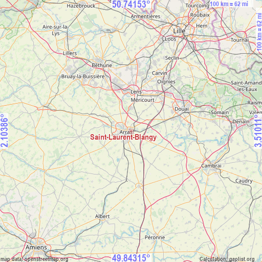
Saint-Laurent-Blangy GPS coordinates[2]
50° 17' 40.056" North, 2° 48' 25.128" East
| Map corner | latitude | longitude |
|---|---|---|
| Upper-left | 50.74153°, | 2.10386° |
| Center: | 50.29446°, | 2.80698° |
| Lower-right: | 49.84315°, | 3.51011° |
| Map W x H: | 99.9×99.9 km | = 62.1×62.1mi |
| max Lat: | 51.07786° ⇑4.5% North |
| Saint-Laurent-Blangy: | 50.29446° |
| min Lat: | ⇓95.5% South 41.3874° |
| min Long | Saint-Laurent-B | max Long |
| -5.08615° | 2.80698° | 9.52242° |
| W 55%⇐ | ⇒45% E |
Elevation
Elevation of Saint-Laurent-Blangy is 71 m = 233 ft, and this is 122.7 m = 403 ft below average elevation for this country.
| Max E: |
2333 m = 7654 ft | 73.1% |
| Avg. | 193.7 m = 635 ft | |
| Saint-Laurent-Blangy | 71 m = 233 ft | |
Min E: |
-1 m = -3 ft | 26.9% |
See also: France elevation on elevation.city.
Geographical zone
Saint-Laurent-Blangy is located in North temperate zone (between Tropic of Cancer and the Arctic Circle). Distance of this North polar circle is 1809 km =1124.1 mi to North.| Distance of | km | miles | from Saint-Laurent-Blangy |
|---|---|---|---|
| North Pole | 4414.8 | 2743.2 | to North |
| Arctic Circle | 1809 | 1124.1 | to North |
| Tropic Cancer | 2986.3 | 1855.6 | to South |
| Equator | 5592.2 | 3474.8 | to South |


Nearby cities:
15 places around Saint-Laurent-Blangy: (largest is in red/bold)
• Achicourt
4.2 km =2.6 mi,  237°
237°
• Agny
5.2 km =3.2 mi,  220°
220°
• Anzin-Saint-Aubin
4.7 km =2.9 mi,  296°
296°
• Arras
1.8 km =1.1 mi,  264°
264°
• Athies
2.3 km =1.4 mi,  69°
69°
• Bailleul-Sir-Berthoult
5.7 km =3.5 mi,  33°
33°
• Beaurains
3.3 km =2.1 mi,  195°
195°
• Dainville
5.9 km =3.7 mi, 255°
• Fampoux
4.8 km =3 mi,  80°
80°
• Feuchy
2.6 km =1.6 mi,  90°
90°
• Neuville-Vitasse
5.3 km =3.3 mi,  169°
169°
• Roclincourt
3.8 km =2.4 mi,  337°
337°
• Saint-Nicolas
2.2 km =1.4 mi, 298°
• Sainte-Catherine
3.4 km =2.1 mi, 295°
• Tilloy-lès-Mofflaines
2.2 km =1.4 mi, 165°
Sources, notices
• [Note1] Compared only with cities in France existing in our database
• [Src1] Map data: © OpenStreetMap contributors (CC-BY-SA)
• [Src2] Other city data from geonames.org with taken over terms of usage.
• [Src3] Geographical zone / Annual Mean Temperature by Robert A. Rohde @ Wikipedia
