Saint-Junien geodata
Saint-Junien (Nouvelle-Aquitaine) is a populated place; located in France in Europe/Paris (GMT+2) time zone. With population of 11,553 people, there are 835 cities with bigger population in this country. Compared to other cities in France, 67.9% of cities are located further ↑North; 69.7% of cities are located further →East and 70.9% of cities have lower elevation than Saint-Junien. Note1
Administrative division(s):
- Level 1: Nouvelle-Aquitaine
- Level 2: Haute-Vienne
- Level 3: Arrondissement de Rochechouart
- Level 4: Saint-Junien


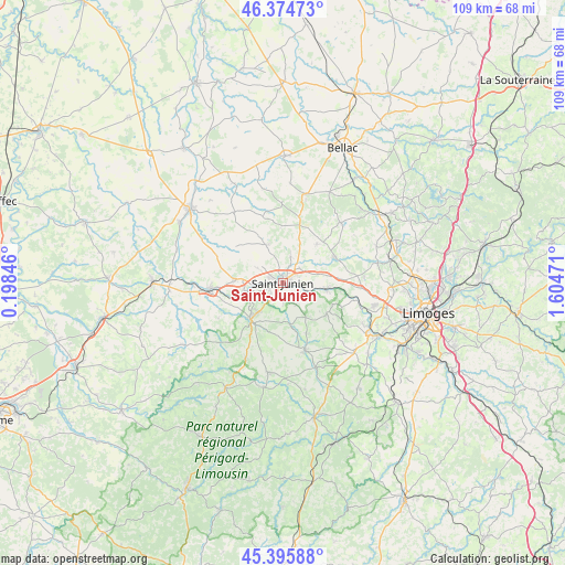
Saint-Junien GPS coordinates[2]
45° 53' 14.856" North, 0° 54' 5.688" East
| Map corner | latitude | longitude |
|---|---|---|
| Upper-left | 46.37473°, | 0.19846° |
| Center: | 45.88746°, | 0.90158° |
| Lower-right: | 45.39588°, | 1.60471° |
| Map W x H: | 108.8×108.8 km | = 67.6×67.6mi |
| max Lat: | 51.07786° ⇑67.9% North |
| Saint-Junien: | 45.88746° |
| min Lat: | ⇓32.1% South 41.3874° |
| min Long | Saint-Junien | max Long |
| -5.08615° | 0.90158° | 9.52242° |
| W 30.3%⇐ | ⇒69.7% E |
Elevation
Elevation of Saint-Junien is 223 m = 732 ft, and this is 29.3 m = 96 ft above average elevation for this country.
| Max E: |
2333 m = 7654 ft | 29.1% |
| Saint-Junien | 223 m 732 ft | |
| Avg. | 193.7 m = 635 ft | |
Min E: |
-1 m = -3 ft | 70.9% |
See also: France elevation on elevation.city.
Geographical zone
Saint-Junien is located in North temperate zone (between Tropic of Cancer and the Arctic Circle). Distance of this North polar circle is 2299 km =1428.5 mi to North.| Distance of | km | miles | from Saint-Junien |
|---|---|---|---|
| North Pole | 4904.9 | 3047.8 | to North |
| Arctic Circle | 2299 | 1428.5 | to North |
| Tropic Cancer | 2496.3 | 1551.1 | to South |
| Equator | 5102.2 | 3170.4 | to South |


Nearby cities:
15 places around Saint-Junien: (largest is in red/bold)
• Brigueuil
8 km =5 mi,  336°
336°
• Chabanais
14.3 km =8.9 mi,  263°
263°
• Chaillac-sur-Vienne
2.4 km =1.5 mi,  247°
247°
• Chassenon
11.3 km =7 mi, 249°
• Cognac-la-Forêt
10.3 km =6.4 mi,  125°
125°
• Javerdat
9.9 km =6.2 mi,  41°
41°
• Oradour-sur-Glane
11.2 km =7 mi,  62°
62°
• Rochechouart
9.5 km =5.9 mi,  221°
221°
• Saillat-sur-Vienne
6.9 km =4.3 mi, 255°
• Saint-Auvent
9.5 km =5.9 mi,  165°
165°
• Saint-Brice-sur-Vienne
4.1 km =2.5 mi,  101°
101°
• Saint-Cyr
10.7 km =6.6 mi,  155°
155°
• Saint-Laurent-sur-Gorre
13.8 km =8.6 mi, 161°
• Saint-Victurnien
8.7 km =5.4 mi, 97°
• Étagnac
9.5 km =5.9 mi,  275°
275°
Sources, notices
• [Note1] Compared only with cities in France existing in our database
• [Src1] Map data: © OpenStreetMap contributors (CC-BY-SA)
• [Src2] Other city data from geonames.org with taken over terms of usage.
• [Src3] Geographical zone / Annual Mean Temperature by Robert A. Rohde @ Wikipedia
