Saint-Laurent-du-Pape geodata
Saint-Laurent-du-Pape (Auvergne-Rhône-Alpes) is a populated place; located in France in Europe/Paris (GMT+2) time zone. With population of 1,368 people, there are 6731 cities with bigger population in this country. Compared to other cities in France, 81.2% of cities are located further ↑North; 74.6% of cities are located further ←West and 57.6% of cities have lower elevation than Saint-Laurent-du-Pape. Note1
Administrative division(s):
- Level 1: Auvergne-Rhône-Alpes
- Level 2: Département de l'Ardèche
- Level 3: Arrondissement de Privas
- Level 4: Saint-Laurent-du-Pape
Current local time in Saint-Laurent-du-Pape:
05:52 AM, WednesdayDifference from your time zone: hours


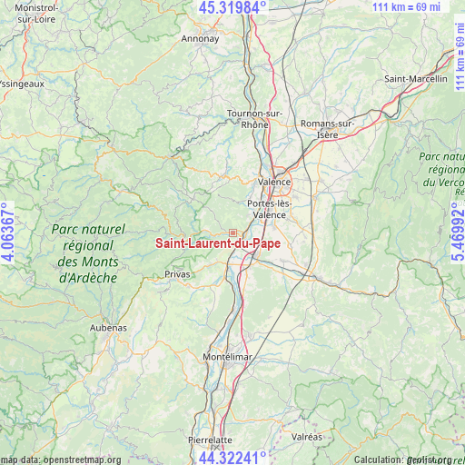
Saint-Laurent-du-Pape GPS coordinates[2]
44° 49' 23.808" North, 4° 46' 0.444" East
| Map corner | latitude | longitude |
|---|---|---|
| Upper-left | 45.31984°, | 4.06367° |
| Center: | 44.82328°, | 4.76679° |
| Lower-right: | 44.32241°, | 5.46992° |
| Map W x H: | 110.9×110.9 km | = 68.9×68.9mi |
| max Lat: | 51.07786° ⇑81.2% North |
| Saint-Laurent-du-Pape: | 44.82328° |
| min Lat: | ⇓18.8% South 41.3874° |
| min Long | Saint-Laurent-d | max Long |
| -5.08615° | 4.76679° | 9.52242° |
| W 74.6%⇐ | ⇒25.4% E |
Elevation
Elevation of Saint-Laurent-du-Pape is 160 m = 525 ft, and this is 33.7 m = 111 ft below average elevation for this country.
| Max E: |
2333 m = 7654 ft | 42.4% |
| Avg. | 193.7 m = 635 ft | |
| Saint-Laurent-du-Pape | 160 m = 525 ft | |
Min E: |
-1 m = -3 ft | 57.6% |
See also: France elevation on elevation.city.
Geographical zone
Saint-Laurent-du-Pape is located in North temperate zone (between Tropic of Cancer and the Arctic Circle). Distance of this Northern Tropic circle is 2378 km =1477.6 mi to South.| Distance of | km | miles | from Saint-Laurent-du-Pape |
|---|---|---|---|
| North Pole | 5023.2 | 3121.3 | to North |
| Arctic Circle | 2417.3 | 1502 | to North |
| Tropic Cancer | 2378 | 1477.6 | to South |
| Equator | 4983.9 | 3096.9 | to South |


Nearby cities:
15 places around Saint-Laurent-du-Pape: (largest is in red/bold)
• Beauchastel
2.9 km =1.8 mi,  84°
84°
• Charmes-sur-Rhône
7 km =4.3 mi,  50°
50°
• Flaviac
11.1 km =6.9 mi,  220°
220°
• La Voulte-sur-Rhône
2.8 km =1.7 mi,  159°
159°
• Le Pouzin
8.1 km =5 mi,  190°
190°
• Livron-sur-Drôme
7.9 km =4.9 mi,  131°
131°
• Loriol-sur-Drôme
9.4 km =5.8 mi,  154°
154°
• Portes-lès-Valence
10.3 km =6.4 mi,  55°
55°
• Rompon
6 km =3.7 mi,  206°
206°
• Saint-Fortunat-sur-Eyrieux
7.2 km =4.5 mi,  275°
275°
• Saint-Georges-les-Bains
5.4 km =3.4 mi,  38°
38°
• Saint-Julien-en-Saint-Alban
9.5 km =5.9 mi, 215°
• Soyons
9.8 km =6.1 mi, 41°
• Toulaud
9.2 km =5.7 mi,  25°
25°
• Étoile-sur-Rhône
9.9 km =6.2 mi, 79°
Sources, notices
• [Note1] Compared only with cities in France existing in our database
• [Src1] Map data: © OpenStreetMap contributors (CC-BY-SA)
• [Src2] Other city data from geonames.org with taken over terms of usage.
• [Src3] Geographical zone / Annual Mean Temperature by Robert A. Rohde @ Wikipedia
