Saint-Jean-Lasseille geodata
Saint-Jean-Lasseille (Occitanie) is a populated place; located in France in Europe/Paris (GMT+2) time zone. With population of 624 people, there are 12917 cities with bigger population in this country. Compared to other cities in France, 99.3% of cities are located further ↑North; 55.9% of cities are located further ←West and 73.1% of cities have higher elevation than Saint-Jean-Lasseille. Note1
Administrative division(s):
- Level 1: Occitanie
- Level 2: Département des Pyrénées-Orientales
- Level 3: Arrondissement de Céret
- Level 4: Saint-Jean-Lasseille
Current local time in Saint-Jean-Lasseille:
04:17 AM, WednesdayDifference from your time zone: hours


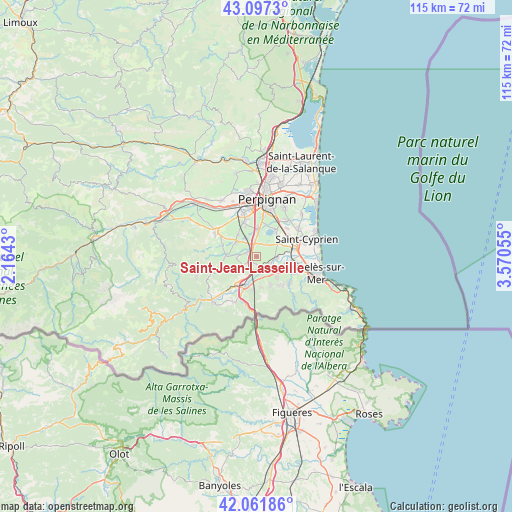
Saint-Jean-Lasseille GPS coordinates[2]
42° 34' 54.228" North, 2° 52' 2.712" East
| Map corner | latitude | longitude |
|---|---|---|
| Upper-left | 43.0973°, | 2.1643° |
| Center: | 42.58173°, | 2.86742° |
| Lower-right: | 42.06186°, | 3.57055° |
| Map W x H: | 115.1×115.1 km | = 71.5×71.5mi |
| max Lat: | 51.07786° ⇑99.3% North |
| Saint-Jean-Lasseille: | 42.58173° |
| min Lat: | ⇓0.7% South 41.3874° |
| min Long | Saint-Jean-Lass | max Long |
| -5.08615° | 2.86742° | 9.52242° |
| W 55.9%⇐ | ⇒44.1% E |
Elevation
Elevation of Saint-Jean-Lasseille is 71 m = 233 ft, and this is 122.7 m = 403 ft below average elevation for this country.
| Max E: |
2333 m = 7654 ft | 73.1% |
| Avg. | 193.7 m = 635 ft | |
| Saint-Jean-Lasseille | 71 m = 233 ft | |
Min E: |
-1 m = -3 ft | 26.9% |
See also: France elevation on elevation.city.
Geographical zone
Saint-Jean-Lasseille is located in North temperate zone (between Tropic of Cancer and the Arctic Circle). Distance of this Northern Tropic circle is 2128.7 km =1322.7 mi to South.| Distance of | km | miles | from Saint-Jean-Lasseille |
|---|---|---|---|
| North Pole | 5272.4 | 3276.1 | to North |
| Arctic Circle | 2666.5 | 1656.9 | to North |
| Tropic Cancer | 2128.7 | 1322.7 | to South |
| Equator | 4734.6 | 2941.9 | to South |


Nearby cities:
15 places around Saint-Jean-Lasseille: (largest is in red/bold)
• Bages
3.4 km =2.1 mi,  38°
38°
• Banyuls-dels-Aspres
1.8 km =1.1 mi,  181°
181°
• Brouilla
3.4 km =2.1 mi,  120°
120°
• Montescot
6.1 km =3.8 mi,  62°
62°
• Ortaffa
4.8 km =3 mi,  92°
92°
• Passa
4.6 km =2.9 mi,  265°
265°
• Pollestres
6.7 km =4.2 mi,  2°
2°
• Ponteilla
6.6 km =4.1 mi,  318°
318°
• Saint-Génis-des-Fontaines
6.1 km =3.8 mi,  134°
134°
• Tresserre
3.7 km =2.3 mi,  237°
237°
• Trouillas
5.8 km =3.6 mi,  303°
303°
• Vilallonga dels Monts
6.9 km =4.3 mi,  154°
154°
• Villemolaque
2.4 km =1.5 mi,  287°
287°
• Villeneuve-de-la-Raho
7.2 km =4.5 mi,  33°
33°
• el Voló
7 km =4.3 mi,  203°
203°
Sources, notices
• [Note1] Compared only with cities in France existing in our database
• [Src1] Map data: © OpenStreetMap contributors (CC-BY-SA)
• [Src2] Other city data from geonames.org with taken over terms of usage.
• [Src3] Geographical zone / Annual Mean Temperature by Robert A. Rohde @ Wikipedia
