Saint-Épain geodata
Saint-Épain (Centre) is a populated place; located in France in Europe/Paris (GMT+2) time zone. With population of 1,478 people, there are 6259 cities with bigger population in this country. Compared to other cities in France, 53.7% of cities are located further ↑North; 73.1% of cities are located further →East and 78.6% of cities have higher elevation than Saint-Épain. Note1
Administrative division(s):
- Level 1: Centre
- Level 2: Département d'Indre-et-Loire
- Level 3: Arrondissement de Chinon
- Level 4: Saint-Épain


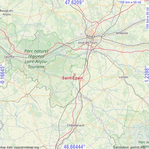
Saint-Épain GPS coordinates[2]
47° 8' 41.352" North, 0° 32' 12.048" East
| Map corner | latitude | longitude |
|---|---|---|
| Upper-left | 47.6209°, | -0.16645° |
| Center: | 47.14482°, | 0.53668° |
| Lower-right: | 46.66444°, | 1.2398° |
| Map W x H: | 106.3×106.3 km | = 66.1×66.1mi |
| max Lat: | 51.07786° ⇑53.7% North |
| Saint-Épain: | 47.14482° |
| min Lat: | ⇓46.3% South 41.3874° |
| min Long | Saint-Épain | max Long |
| -5.08615° | 0.53668° | 9.52242° |
| W 26.9%⇐ | ⇒73.1% E |
Elevation
Elevation of Saint-Épain is 58 m = 190 ft, and this is 135.7 m = 445 ft below average elevation for this country.
| Max E: |
2333 m = 7654 ft | 78.6% |
| Avg. | 193.7 m = 635 ft | |
| Saint-Épain | 58 m = 190 ft | |
Min E: |
-1 m = -3 ft | 21.4% |
See also: France elevation on elevation.city.
Geographical zone
Saint-Épain is located in North temperate zone (between Tropic of Cancer and the Arctic Circle). Distance of this North polar circle is 2159.2 km =1341.7 mi to North.| Distance of | km | miles | from Saint-Épain |
|---|---|---|---|
| North Pole | 4765 | 2960.8 | to North |
| Arctic Circle | 2159.2 | 1341.7 | to North |
| Tropic Cancer | 2636.1 | 1638 | to South |
| Equator | 5242 | 3257.2 | to South |


Nearby cities:
15 places around Saint-Épain: (largest is in red/bold)
• Avon-les-Roches
6.8 km =4.2 mi,  281°
281°
• Crouzilles
6.3 km =3.9 mi,  248°
248°
• L'Île-Bouchard
9.6 km =6 mi, 250°
• Maillé
10.7 km =6.6 mi,  161°
161°
• Marcilly-sur-Vienne
11.3 km =7 mi,  178°
178°
• Nouâtre
10.5 km =6.5 mi,  174°
174°
• Noyant-de-Touraine
4.2 km =2.6 mi, 155°
• Panzoult
10.2 km =6.3 mi,  270°
270°
• Parçay-sur-Vienne
6.3 km =3.9 mi,  226°
226°
• Pouzay
6.9 km =4.3 mi, 182°
• Sainte-Catherine-de-Fierbois
9.1 km =5.7 mi,  81°
81°
• Sainte-Maure-de-Touraine
7.5 km =4.7 mi,  119°
119°
• Thilouze
9.4 km =5.8 mi,  20°
20°
• Villaines-les-Rochers
9.1 km =5.7 mi,  340°
340°
• Villeperdue
9.8 km =6.1 mi,  49°
49°
Sources, notices
• [Note1] Compared only with cities in France existing in our database
• [Src1] Map data: © OpenStreetMap contributors (CC-BY-SA)
• [Src2] Other city data from geonames.org with taken over terms of usage.
• [Src3] Geographical zone / Annual Mean Temperature by Robert A. Rohde @ Wikipedia
