Saint-Dolay geodata
Saint-Dolay (Brittany) is a populated place; located in France in Europe/Paris (GMT+2) time zone. With population of 2,116 people, there are 4548 cities with bigger population in this country. Compared to other cities in France, 51.9% of cities are located further ↓South; 95.4% of cities are located further →East and 82.2% of cities have higher elevation than Saint-Dolay. Note1
Administrative division(s):
- Level 1: Brittany
- Level 2: Morbihan
- Level 3: Arrondissement de Vannes
- Level 4: Saint-Dolay


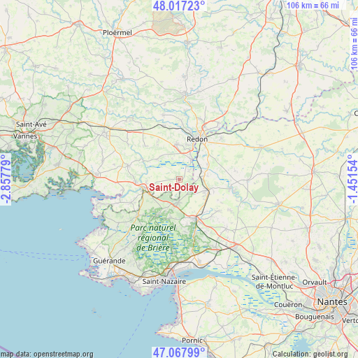
Saint-Dolay GPS coordinates[2]
47° 32' 41.136" North, 2° 9' 16.776" West
| Map corner | latitude | longitude |
|---|---|---|
| Upper-left | 48.01723°, | -2.85779° |
| Center: | 47.54476°, | -2.15466° |
| Lower-right: | 47.06799°, | -1.45154° |
| Map W x H: | 105.5×105.5 km | = 65.6×65.6mi |
| max Lat: | 51.07786° ⇑48.1% North |
| Saint-Dolay: | 47.54476° |
| min Lat: | ⇓51.9% South 41.3874° |
| min Long | Saint-Dolay | max Long |
| -5.08615° | -2.15466° | 9.52242° |
| W 4.6%⇐ | ⇒95.4% E |
Elevation
Elevation of Saint-Dolay is 49 m = 161 ft, and this is 144.7 m = 475 ft below average elevation for this country.
| Max E: |
2333 m = 7654 ft | 82.2% |
| Avg. | 193.7 m = 635 ft | |
| Saint-Dolay | 49 m = 161 ft | |
Min E: |
-1 m = -3 ft | 17.8% |
See also: France elevation on elevation.city.
Geographical zone
Saint-Dolay is located in North temperate zone (between Tropic of Cancer and the Arctic Circle). Distance of this North polar circle is 2114.7 km =1314 mi to North.| Distance of | km | miles | from Saint-Dolay |
|---|---|---|---|
| North Pole | 4720.6 | 2933.2 | to North |
| Arctic Circle | 2114.7 | 1314 | to North |
| Tropic Cancer | 2680.6 | 1665.6 | to South |
| Equator | 5286.5 | 3284.9 | to South |


Nearby cities:
15 places around Saint-Dolay: (largest is in red/bold)
• Allaire
10.3 km =6.4 mi,  356°
356°
• Béganne
8.7 km =5.4 mi,  311°
311°
• Drefféac
10.7 km =6.6 mi,  136°
136°
• Fégréac
9.4 km =5.8 mi,  61°
61°
• La Chapelle-des-Marais
12.4 km =7.7 mi,  210°
210°
• La Roche-Bernard
11.4 km =7.1 mi,  255°
255°
• Missillac
7 km =4.3 mi,  183°
183°
• Nivillac
9.7 km =6 mi, 262°
• Pontchâteau
12.8 km =8 mi,  157°
157°
• Rieux
6.8 km =4.2 mi,  30°
30°
• Saint-Gildas-des-Bois
9.4 km =5.8 mi,  109°
109°
• Saint-Jean-la-Poterie
10.4 km =6.5 mi,  12°
12°
• Sainte-Reine-de-Bretagne
11.8 km =7.3 mi,  193°
193°
• Sévérac
6 km =3.7 mi,  84°
84°
• Théhillac
3.7 km =2.3 mi,  49°
49°
Sources, notices
• [Note1] Compared only with cities in France existing in our database
• [Src1] Map data: © OpenStreetMap contributors (CC-BY-SA)
• [Src2] Other city data from geonames.org with taken over terms of usage.
• [Src3] Geographical zone / Annual Mean Temperature by Robert A. Rohde @ Wikipedia
