Saint-Clair-du-Rhône geodata
Saint-Clair-du-Rhône (Auvergne-Rhône-Alpes) is a populated place; located in France in Europe/Paris (GMT+2) time zone. With population of 3,888 people, there are 2527 cities with bigger population in this country. Compared to other cities in France, 74.8% of cities are located further ↑North; 74.7% of cities are located further ←West and 75% of cities have lower elevation than Saint-Clair-du-Rhône. Note1
Administrative division(s):
- Level 1: Auvergne-Rhône-Alpes
- Level 2: Département de l'Isère
- Level 3: Arrondissement de Vienne
- Level 4: Saint-Clair-du-Rhône


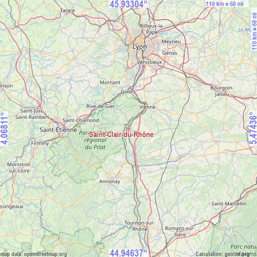
Saint-Clair-du-Rhône GPS coordinates[2]
45° 26' 30.696" North, 4° 46' 16.428" East
| Map corner | latitude | longitude |
|---|---|---|
| Upper-left | 45.93304°, | 4.06811° |
| Center: | 45.44186°, | 4.77123° |
| Lower-right: | 44.94637°, | 5.47436° |
| Map W x H: | 109.7×109.7 km | = 68.2×68.2mi |
| max Lat: | 51.07786° ⇑74.8% North |
| Saint-Clair-du-Rhône: | 45.44186° |
| min Lat: | ⇓25.2% South 41.3874° |
| min Long | Saint-Clair-du- | max Long |
| -5.08615° | 4.77123° | 9.52242° |
| W 74.7%⇐ | ⇒25.3% E |
Elevation
Elevation of Saint-Clair-du-Rhône is 249 m = 817 ft, and this is 55.3 m = 181 ft above average elevation for this country.
| Max E: |
2333 m = 7654 ft | 25% |
| Saint-Clair-du-Rhône | 249 m 817 ft | |
| Avg. | 193.7 m = 635 ft | |
Min E: |
-1 m = -3 ft | 75% |
See also: France elevation on elevation.city.
Geographical zone
Saint-Clair-du-Rhône is located in North temperate zone (between Tropic of Cancer and the Arctic Circle). Distance of this North polar circle is 2348.5 km =1459.3 mi to North.| Distance of | km | miles | from Saint-Clair-du-Rhône |
|---|---|---|---|
| North Pole | 4954.4 | 3078.5 | to North |
| Arctic Circle | 2348.5 | 1459.3 | to North |
| Tropic Cancer | 2446.7 | 1520.3 | to South |
| Equator | 5052.7 | 3139.6 | to South |


Nearby cities:
15 places around Saint-Clair-du-Rhône: (largest is in red/bold)
• Ampuis
6.1 km =3.8 mi,  29°
29°
• Auberives-sur-Varèze
4.4 km =2.7 mi,  122°
122°
• Chavanay
4.5 km =2.8 mi,  231°
231°
• Cheyssieu
5.5 km =3.4 mi,  105°
105°
• Chuyer
6.3 km =3.9 mi,  285°
285°
• Clonas-sur-Varèze
3.5 km =2.2 mi,  153°
153°
• Condrieu
2.4 km =1.5 mi,  353°
353°
• Les Haies
7.2 km =4.5 mi, 345°
• Les Roches-de-Condrieu
1.3 km =0.8 mi, 345°
• Pélussin
7.3 km =4.5 mi,  250°
250°
• Reventin-Vaugris
6.2 km =3.9 mi,  63°
63°
• Saint-Alban-du-Rhône
2.5 km =1.6 mi,  203°
203°
• Saint-Michel-sur-Rhône
2.4 km =1.5 mi,  265°
265°
• Saint-Prim
1.3 km =0.8 mi,  51°
51°
• Vérin
1.9 km =1.2 mi,  313°
313°
Sources, notices
• [Note1] Compared only with cities in France existing in our database
• [Src1] Map data: © OpenStreetMap contributors (CC-BY-SA)
• [Src2] Other city data from geonames.org with taken over terms of usage.
• [Src3] Geographical zone / Annual Mean Temperature by Robert A. Rohde @ Wikipedia
