Baudrières geodata
Baudrières (Bourgogne-Franche-Comté) is a populated place; located in France in Europe/Paris (GMT+2) time zone. With population of 808 people, there are 10506 cities with bigger population in this country. Compared to other cities in France, 58.5% of cities are located further ↑North; 77.8% of cities are located further ←West and 65.6% of cities have lower elevation than Baudrières. Note1
Administrative division(s):
- Level 1: Bourgogne-Franche-Comté
- Level 2: Département de Saône-et-Loire
- Level 3: Arrondissement de Louhans
- Level 4: Baudrières


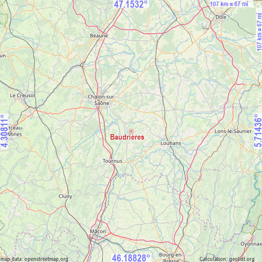
Baudrières GPS coordinates[2]
46° 40' 22.404" North, 5° 0' 40.464" East
| Map corner | latitude | longitude |
|---|---|---|
| Upper-left | 47.1532°, | 4.30811° |
| Center: | 46.67289°, | 5.01124° |
| Lower-right: | 46.18828°, | 5.71436° |
| Map W x H: | 107.3×107.3 km | = 66.7×66.7mi |
| max Lat: | 51.07786° ⇑58.5% North |
| Baudrières: | 46.67289° |
| min Lat: | ⇓41.5% South 41.3874° |
| min Long | Baudrières | max Long |
| -5.08615° | 5.01124° | 9.52242° |
| W 77.8%⇐ | ⇒22.2% E |
Elevation
Elevation of Baudrières is 197 m = 646 ft, and this is 3.3 m = 11 ft above average elevation for this country.
| Max E: |
2333 m = 7654 ft | 34.4% |
| Baudrières | 197 m 646 ft | |
| Avg. | 193.7 m = 635 ft | |
Min E: |
-1 m = -3 ft | 65.6% |
See also: France elevation on elevation.city.
Geographical zone
Baudrières is located in North temperate zone (between Tropic of Cancer and the Arctic Circle). Distance of this North polar circle is 2211.6 km =1374.2 mi to North.| Distance of | km | miles | from Baudrières |
|---|---|---|---|
| North Pole | 4817.5 | 2993.5 | to North |
| Arctic Circle | 2211.6 | 1374.2 | to North |
| Tropic Cancer | 2583.6 | 1605.4 | to South |
| Equator | 5189.5 | 3224.6 | to South |


Nearby cities:
15 places around Baudrières: (largest is in red/bold)
• Cuisery
12.9 km =8 mi,  184°
184°
• Gigny-sur-Saône
5.2 km =3.2 mi,  256°
256°
• Lans
12.8 km =8 mi,  327°
327°
• Loisy
10.3 km =6.4 mi,  173°
173°
• Montret
8 km =5 mi,  82°
82°
• Ouroux-sur-Saône
7 km =4.3 mi,  320°
320°
• Rancy
10.5 km =6.5 mi,  143°
143°
• Saint-Christophe-en-Bresse
9 km =5.6 mi,  348°
348°
• Saint-Cyr
9.3 km =5.8 mi,  276°
276°
• Saint-Germain-du-Plain
3.6 km =2.2 mi, 325°
• Saint-Étienne-en-Bresse
4.8 km =3 mi,  39°
39°
• Sennecey-le-Grand
11.5 km =7.1 mi,  252°
252°
• Simandre
5.8 km =3.6 mi,  198°
198°
• Varennes-le-Grand
12 km =7.5 mi,  295°
295°
• Épervans
12.3 km =7.6 mi, 316°
Sources, notices
• [Note1] Compared only with cities in France existing in our database
• [Src1] Map data: © OpenStreetMap contributors (CC-BY-SA)
• [Src2] Other city data from geonames.org with taken over terms of usage.
• [Src3] Geographical zone / Annual Mean Temperature by Robert A. Rohde @ Wikipedia
