Saint-Baudelle geodata
Saint-Baudelle (Pays de la Loire) is a populated place; located in France in Europe/Paris (GMT+2) time zone. With population of 1,062 people, there are 8387 cities with bigger population in this country. Compared to other cities in France, 64.2% of cities are located further ↓South; 84.9% of cities are located further →East and 53.1% of cities have higher elevation than Saint-Baudelle. Note1
Administrative division(s):
- Level 1: Pays de la Loire
- Level 2: Mayenne
- Level 3: Arrondissement de Mayenne
- Level 4: Saint-Baudelle


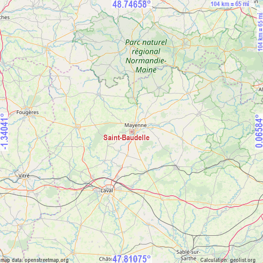
Saint-Baudelle GPS coordinates[2]
48° 16' 50.916" North, 0° 38' 14.208" West
| Map corner | latitude | longitude |
|---|---|---|
| Upper-left | 48.74658°, | -1.34041° |
| Center: | 48.28081°, | -0.63728° |
| Lower-right: | 47.81075°, | 0.06584° |
| Map W x H: | 104.1×104.1 km | = 64.7×64.7mi |
| max Lat: | 51.07786° ⇑35.8% North |
| Saint-Baudelle: | 48.28081° |
| min Lat: | ⇓64.2% South 41.3874° |
| min Long | Saint-Baudelle | max Long |
| -5.08615° | -0.63728° | 9.52242° |
| W 15.1%⇐ | ⇒84.9% E |
Elevation
Elevation of Saint-Baudelle is 122 m = 400 ft, and this is 71.7 m = 235 ft below average elevation for this country.
| Max E: |
2333 m = 7654 ft | 53.1% |
| Avg. | 193.7 m = 635 ft | |
| Saint-Baudelle | 122 m = 400 ft | |
Min E: |
-1 m = -3 ft | 46.9% |
See also: France elevation on elevation.city.
Geographical zone
Saint-Baudelle is located in North temperate zone (between Tropic of Cancer and the Arctic Circle). Distance of this North polar circle is 2032.9 km =1263.2 mi to North.| Distance of | km | miles | from Saint-Baudelle |
|---|---|---|---|
| North Pole | 4638.7 | 2882.4 | to North |
| Arctic Circle | 2032.9 | 1263.2 | to North |
| Tropic Cancer | 2762.4 | 1716.5 | to South |
| Equator | 5368.3 | 3335.7 | to South |


Nearby cities:
15 places around Saint-Baudelle: (largest is in red/bold)
• Aron
6 km =3.7 mi,  71°
71°
• Châtillon-sur-Colmont
10.1 km =6.3 mi,  308°
308°
• Commer
5.5 km =3.4 mi,  163°
163°
• Contest
2.5 km =1.6 mi,  215°
215°
• Grazay
11.6 km =7.2 mi,  84°
84°
• Jublains
10.8 km =6.7 mi,  104°
104°
• La Bazoge-Montpinçon
4.7 km =2.9 mi,  93°
93°
• Marcillé-la-Ville
11 km =6.8 mi, 75°
• Martigné-sur-Mayenne
9.2 km =5.7 mi,  193°
193°
• Mayenne
3 km =1.9 mi,  35°
35°
• Moulay
1.2 km =0.7 mi,  141°
141°
• Oisseau
8.7 km =5.4 mi,  343°
343°
• Parigné-sur-Braye
4 km =2.5 mi, 343°
• Saint-Fraimbault-de-Prières
8.7 km =5.4 mi,  29°
29°
• Saint-Georges-Buttavent
5.3 km =3.3 mi, 308°
Sources, notices
• [Note1] Compared only with cities in France existing in our database
• [Src1] Map data: © OpenStreetMap contributors (CC-BY-SA)
• [Src2] Other city data from geonames.org with taken over terms of usage.
• [Src3] Geographical zone / Annual Mean Temperature by Robert A. Rohde @ Wikipedia
