Commer geodata
Commer (Pays de la Loire) is a populated place; located in France in Europe/Paris (GMT+2) time zone. With population of 1,142 people, there are 7876 cities with bigger population in this country. Compared to other cities in France, 63.3% of cities are located further ↓South; 84.7% of cities are located further →East and 50.6% of cities have lower elevation than Commer. Note1
Administrative division(s):
- Level 1: Pays de la Loire
- Level 2: Mayenne
- Level 3: Arrondissement de Mayenne
- Level 4: Commer


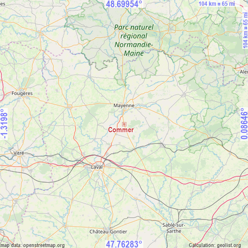
Commer GPS coordinates[2]
48° 13' 59.988" North, 0° 37' 0.012" West
| Map corner | latitude | longitude |
|---|---|---|
| Upper-left | 48.69954°, | -1.3198° |
| Center: | 48.23333°, | -0.61667° |
| Lower-right: | 47.76283°, | 0.08646° |
| Map W x H: | 104.2×104.2 km | = 64.7×64.7mi |
| max Lat: | 51.07786° ⇑36.7% North |
| Commer: | 48.23333° |
| min Lat: | ⇓63.3% South 41.3874° |
| min Long | Commer | max Long |
| -5.08615° | -0.61667° | 9.52242° |
| W 15.3%⇐ | ⇒84.7% E |
Elevation
Elevation of Commer is 134 m = 440 ft, and this is 59.7 m = 196 ft below average elevation for this country.
| Max E: |
2333 m = 7654 ft | 49.4% |
| Avg. | 193.7 m = 635 ft | |
| Commer | 134 m = 440 ft | |
Min E: |
-1 m = -3 ft | 50.6% |
See also: France elevation on elevation.city.
Geographical zone
Commer is located in North temperate zone (between Tropic of Cancer and the Arctic Circle). Distance of this North polar circle is 2038.1 km =1266.4 mi to North.| Distance of | km | miles | from Commer |
|---|---|---|---|
| North Pole | 4644 | 2885.6 | to North |
| Arctic Circle | 2038.1 | 1266.4 | to North |
| Tropic Cancer | 2757.1 | 1713.2 | to South |
| Equator | 5363 | 3332.4 | to South |


Nearby cities:
15 places around Commer: (largest is in red/bold)
• Aron
8.3 km =5.2 mi,  30°
30°
• Contest
4.4 km =2.7 mi,  317°
317°
• Grazay
11.9 km =7.4 mi,  57°
57°
• Jublains
9.3 km =5.8 mi,  74°
74°
• La Bazoge-Montpinçon
5.9 km =3.7 mi, 32°
• La Chapelle-Anthenaise
13 km =8.1 mi,  200°
200°
• Marcillé-la-Ville
12.2 km =7.6 mi,  48°
48°
• Martigné-sur-Mayenne
5.2 km =3.2 mi,  224°
224°
• Mayenne
7.8 km =4.8 mi,  1°
1°
• Montsûrs
11.8 km =7.3 mi,  156°
156°
• Moulay
4.4 km =2.7 mi,  349°
349°
• Parigné-sur-Braye
9.5 km =5.9 mi,  343°
343°
• Saint-Baudelle
5.5 km =3.4 mi, 343°
• Saint-Fraimbault-de-Prières
13.2 km =8.2 mi,  12°
12°
• Saint-Georges-Buttavent
10.3 km =6.4 mi,  326°
326°
Sources, notices
• [Note1] Compared only with cities in France existing in our database
• [Src1] Map data: © OpenStreetMap contributors (CC-BY-SA)
• [Src2] Other city data from geonames.org with taken over terms of usage.
• [Src3] Geographical zone / Annual Mean Temperature by Robert A. Rohde @ Wikipedia
