La Bazoge-Montpinçon geodata
La Bazoge-Montpinçon (Pays de la Loire) is a populated place; located in France in Europe/Paris (GMT+2) time zone. With population of 557 people, there are 14072 cities with bigger population in this country. Compared to other cities in France, 64.1% of cities are located further ↓South; 84.2% of cities are located further →East and 52% of cities have higher elevation than La Bazoge-Montpinçon. Note1
Administrative division(s):
- Level 1: Pays de la Loire
- Level 2: Mayenne
- Level 3: Arrondissement de Mayenne
- Level 4: La Bazoge-Montpinçon
Current local time in La Bazoge-Montpinçon:
06:15 AM, WednesdayDifference from your time zone: hours


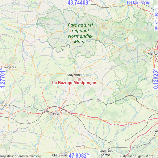
La Bazoge-Montpinçon GPS coordinates[2]
48° 16' 41.808" North, 0° 34' 25.968" West
| Map corner | latitude | longitude |
|---|---|---|
| Upper-left | 48.74408°, | -1.27701° |
| Center: | 48.27828°, | -0.57388° |
| Lower-right: | 47.8082°, | 0.12925° |
| Map W x H: | 104.1×104.1 km | = 64.7×64.7mi |
| max Lat: | 51.07786° ⇑35.9% North |
| La Bazoge-Montpinçon: | 48.27828° |
| min Lat: | ⇓64.1% South 41.3874° |
| min Long | La Bazoge-Montp | max Long |
| -5.08615° | -0.57388° | 9.52242° |
| W 15.8%⇐ | ⇒84.2% E |
Elevation
Elevation of La Bazoge-Montpinçon is 125 m = 410 ft, and this is 68.7 m = 225 ft below average elevation for this country.
| Max E: |
2333 m = 7654 ft | 52% |
| Avg. | 193.7 m = 635 ft | |
| La Bazoge-Montpinçon | 125 m = 410 ft | |
Min E: |
-1 m = -3 ft | 48% |
See also: France elevation on elevation.city.
Geographical zone
La Bazoge-Montpinçon is located in North temperate zone (between Tropic of Cancer and the Arctic Circle). Distance of this North polar circle is 2033.1 km =1263.3 mi to North.| Distance of | km | miles | from La Bazoge-Montpinçon |
|---|---|---|---|
| North Pole | 4639 | 2882.5 | to North |
| Arctic Circle | 2033.1 | 1263.3 | to North |
| Tropic Cancer | 2762.1 | 1716.3 | to South |
| Equator | 5368 | 3335.5 | to South |


Nearby cities:
15 places around La Bazoge-Montpinçon: (largest is in red/bold)
• Aron
2.4 km =1.5 mi,  25°
25°
• Champéon
10.8 km =6.7 mi,  22°
22°
• Commer
5.9 km =3.7 mi,  212°
212°
• Contest
6.4 km =4 mi,  253°
253°
• Grazay
7 km =4.3 mi,  79°
79°
• Jublains
6.3 km =3.9 mi,  113°
113°
• Marcillé-la-Ville
6.7 km =4.2 mi,  62°
62°
• Martigné-sur-Mayenne
11.1 km =6.9 mi,  218°
218°
• Mayenne
4 km =2.5 mi,  313°
313°
• Moulay
4 km =2.5 mi,  260°
260°
• Oisseau
11.2 km =7 mi,  319°
319°
• Parigné-sur-Braye
7.1 km =4.4 mi, 305°
• Saint-Baudelle
4.7 km =2.9 mi,  273°
273°
• Saint-Fraimbault-de-Prières
7.9 km =4.9 mi,  357°
357°
• Saint-Georges-Buttavent
9.5 km =5.9 mi,  291°
291°
Sources, notices
• [Note1] Compared only with cities in France existing in our database
• [Src1] Map data: © OpenStreetMap contributors (CC-BY-SA)
• [Src2] Other city data from geonames.org with taken over terms of usage.
• [Src3] Geographical zone / Annual Mean Temperature by Robert A. Rohde @ Wikipedia
