Saint-Avaugourd-des-Landes geodata
Saint-Avaugourd-des-Landes (Pays de la Loire) is a populated place; located in France in Europe/Paris (GMT+2) time zone. With population of 795 people, there are 10669 cities with bigger population in this country. Compared to other cities in France, 60% of cities are located further ↑North; 92.2% of cities are located further →East and 78.2% of cities have higher elevation than Saint-Avaugourd-des-Landes. Note1
Administrative division(s):
- Level 1: Pays de la Loire
- Level 2: Département de la Vendée
- Level 3: Arrondissement des Sables-d'Olonne
- Level 4: Saint-Avaugourd-des-Landes
Current local time in Saint-Avaugourd-des-Landes:
02:28 PM, SaturdayDifference from your time zone: hours


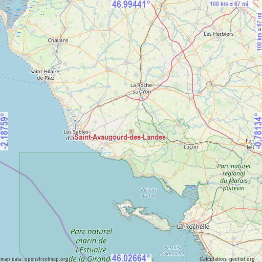
Saint-Avaugourd-des-Landes GPS coordinates[2]
46° 30' 45.648" North, 1° 29' 4.056" West
| Map corner | latitude | longitude |
|---|---|---|
| Upper-left | 46.99441°, | -2.18759° |
| Center: | 46.51268°, | -1.48446° |
| Lower-right: | 46.02664°, | -0.78134° |
| Map W x H: | 107.6×107.6 km | = 66.9×66.9mi |
| max Lat: | 51.07786° ⇑60% North |
| Saint-Avaugourd-des-Landes: | 46.51268° |
| min Lat: | ⇓40% South 41.3874° |
| min Long | Saint-Avaugourd | max Long |
| -5.08615° | -1.48446° | 9.52242° |
| W 7.8%⇐ | ⇒92.2% E |
Elevation
Elevation of Saint-Avaugourd-des-Landes is 59 m = 194 ft, and this is 134.7 m = 442 ft below average elevation for this country.
| Max E: |
2333 m = 7654 ft | 78.2% |
| Avg. | 193.7 m = 635 ft | |
| Saint-Avaugourd-des-Landes | 59 m = 194 ft | |
Min E: |
-1 m = -3 ft | 21.8% |
See also: France elevation on elevation.city.
Geographical zone
Saint-Avaugourd-des-Landes is located in North temperate zone (between Tropic of Cancer and the Arctic Circle). Distance of this North polar circle is 2229.4 km =1385.3 mi to North.| Distance of | km | miles | from Saint-Avaugourd-des-Landes |
|---|---|---|---|
| North Pole | 4835.3 | 3004.5 | to North |
| Arctic Circle | 2229.4 | 1385.3 | to North |
| Tropic Cancer | 2565.8 | 1594.3 | to South |
| Equator | 5171.7 | 3213.5 | to South |


Nearby cities:
15 places around Saint-Avaugourd-des-Landes: (largest is in red/bold)
• Aubigny
9.6 km =6 mi,  14°
14°
• Avrillé
4.9 km =3 mi,  176°
176°
• Grosbreuil
10.5 km =6.5 mi,  286°
286°
• Jard-sur-Mer
13 km =8.1 mi,  212°
212°
• La Boissière-des-Landes
6 km =3.7 mi,  16°
16°
• Le Bernard
8.4 km =5.2 mi,  172°
172°
• Le Champ-Saint-Père
10.5 km =6.5 mi,  93°
93°
• Le Girouard
10.7 km =6.6 mi,  305°
305°
• Longeville-sur-Mer
10.7 km =6.6 mi,  186°
186°
• Moutiers-les-Mauxfaits
6.1 km =3.8 mi,  122°
122°
• Nesmy
10.8 km =6.7 mi,  36°
36°
• Nieul-le-Dolent
7 km =4.3 mi,  345°
345°
• Saint-Hilaire-de-Talmont
10.3 km =6.4 mi,  242°
242°
• Saint-Vincent-sur-Graon
7.3 km =4.5 mi, 86°
• Saint-Vincent-sur-Jard
12.1 km =7.5 mi, 208°
Sources, notices
• [Note1] Compared only with cities in France existing in our database
• [Src1] Map data: © OpenStreetMap contributors (CC-BY-SA)
• [Src2] Other city data from geonames.org with taken over terms of usage.
• [Src3] Geographical zone / Annual Mean Temperature by Robert A. Rohde @ Wikipedia
