Nesmy geodata
Nesmy (Pays de la Loire) is a populated place; located in France in Europe/Paris (GMT+2) time zone. With population of 2,131 people, there are 4511 cities with bigger population in this country. Compared to other cities in France, 59.3% of cities are located further ↑North; 91.5% of cities are located further →East and 76.6% of cities have higher elevation than Nesmy. Note1
Administrative division(s):
- Level 1: Pays de la Loire
- Level 2: Département de la Vendée
- Level 3: Arrondissement de La Roche-sur-Yon
- Level 4: Nesmy


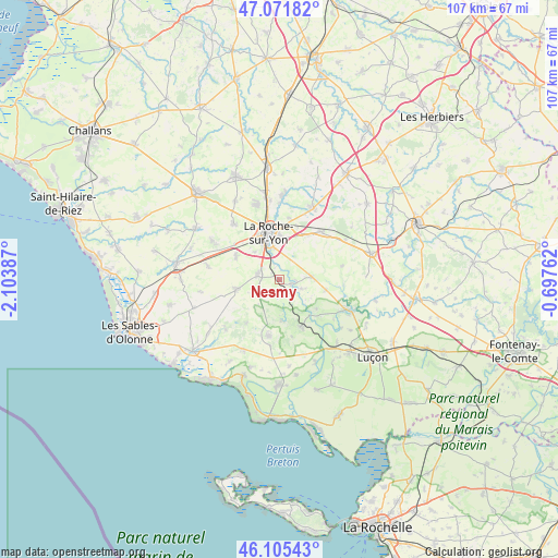
Nesmy GPS coordinates[2]
46° 35' 26.808" North, 1° 24' 2.664" West
| Map corner | latitude | longitude |
|---|---|---|
| Upper-left | 47.07182°, | -2.10387° |
| Center: | 46.59078°, | -1.40074° |
| Lower-right: | 46.10543°, | -0.69762° |
| Map W x H: | 107.5×107.5 km | = 66.8×66.8mi |
| max Lat: | 51.07786° ⇑59.3% North |
| Nesmy: | 46.59078° |
| min Lat: | ⇓40.7% South 41.3874° |
| min Long | Nesmy | max Long |
| -5.08615° | -1.40074° | 9.52242° |
| W 8.5%⇐ | ⇒91.5% E |
Elevation
Elevation of Nesmy is 63 m = 207 ft, and this is 130.7 m = 429 ft below average elevation for this country.
| Max E: |
2333 m = 7654 ft | 76.6% |
| Avg. | 193.7 m = 635 ft | |
| Nesmy | 63 m = 207 ft | |
Min E: |
-1 m = -3 ft | 23.4% |
See also: France elevation on elevation.city.
Geographical zone
Nesmy is located in North temperate zone (between Tropic of Cancer and the Arctic Circle). Distance of this North polar circle is 2220.8 km =1379.9 mi to North.| Distance of | km | miles | from Nesmy |
|---|---|---|---|
| North Pole | 4826.7 | 2999.2 | to North |
| Arctic Circle | 2220.8 | 1379.9 | to North |
| Tropic Cancer | 2574.5 | 1599.7 | to South |
| Equator | 5180.4 | 3219 | to South |


Nearby cities:
15 places around Nesmy: (largest is in red/bold)
• Aubigny
4.1 km =2.5 mi,  278°
278°
• Château-Guibert
12.6 km =7.8 mi,  94°
94°
• La Boissière-des-Landes
5.5 km =3.4 mi,  237°
237°
• La Chaize-le-Vicomte
12.3 km =7.6 mi,  43°
43°
• La Roche-sur-Yon
8.8 km =5.5 mi,  343°
343°
• Le Champ-Saint-Père
10.1 km =6.3 mi,  156°
156°
• Les Clouzeaux
9.3 km =5.8 mi,  296°
296°
• Moutiers-les-Mauxfaits
12 km =7.5 mi,  185°
185°
• Nieul-le-Dolent
8.4 km =5.2 mi,  257°
257°
• Saint-Avaugourd-des-Landes
10.8 km =6.7 mi,  216°
216°
• Saint-Florent-des-Bois
6.5 km =4 mi, 87°
• Saint-Vincent-sur-Graon
8.3 km =5.2 mi,  173°
173°
• Sainte-Flaive-des-Loups
14 km =8.7 mi, 280°
• Thorigny
12.4 km =7.7 mi,  78°
78°
• Venansault
13.6 km =8.5 mi,  320°
320°
Sources, notices
• [Note1] Compared only with cities in France existing in our database
• [Src1] Map data: © OpenStreetMap contributors (CC-BY-SA)
• [Src2] Other city data from geonames.org with taken over terms of usage.
• [Src3] Geographical zone / Annual Mean Temperature by Robert A. Rohde @ Wikipedia
