Saint-Aubin-sur-Scie geodata
Saint-Aubin-sur-Scie (Normandy) is a populated place; located in France in Europe/Paris (GMT+2) time zone. With population of 1,259 people, there are 7237 cities with bigger population in this country. Compared to other cities in France, 92.8% of cities are located further ↓South; 68.1% of cities are located further →East and 93.1% of cities have higher elevation than Saint-Aubin-sur-Scie. Note1
Administrative division(s):
- Level 1: Normandy
- Level 2: Seine-Maritime
- Level 3: Arrondissement de Dieppe
- Level 4: Saint-Aubin-sur-Scie


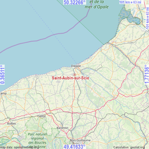
Saint-Aubin-sur-Scie GPS coordinates[2]
49° 52' 17.832" North, 1° 4' 5.628" East
| Map corner | latitude | longitude |
|---|---|---|
| Upper-left | 50.32266°, | 0.36511° |
| Center: | 49.87162°, | 1.06823° |
| Lower-right: | 49.41633°, | 1.77136° |
| Map W x H: | 100.8×100.8 km | = 62.6×62.6mi |
| max Lat: | 51.07786° ⇑7.2% North |
| Saint-Aubin-sur-Scie: | 49.87162° |
| min Lat: | ⇓92.8% South 41.3874° |
| min Long | Saint-Aubin-sur | max Long |
| -5.08615° | 1.06823° | 9.52242° |
| W 31.9%⇐ | ⇒68.1% E |
Elevation
Elevation of Saint-Aubin-sur-Scie is 22 m = 72 ft, and this is 171.7 m = 563 ft below average elevation for this country.
| Max E: |
2333 m = 7654 ft | 93.1% |
| Avg. | 193.7 m = 635 ft | |
| Saint-Aubin-sur-Scie | 22 m = 72 ft | |
Min E: |
-1 m = -3 ft | 6.9% |
See also: France elevation on elevation.city.
Geographical zone
Saint-Aubin-sur-Scie is located in North temperate zone (between Tropic of Cancer and the Arctic Circle). Distance of this North polar circle is 1856 km =1153.3 mi to North.| Distance of | km | miles | from Saint-Aubin-sur-Scie |
|---|---|---|---|
| North Pole | 4461.9 | 2772.5 | to North |
| Arctic Circle | 1856 | 1153.3 | to North |
| Tropic Cancer | 2939.3 | 1826.4 | to South |
| Equator | 5545.2 | 3445.6 | to South |


Nearby cities:
15 places around Saint-Aubin-sur-Scie: (largest is in red/bold)
• Arques-la-Bataille
4.5 km =2.8 mi,  76°
76°
• Auppegard
5.5 km =3.4 mi,  211°
211°
• Dieppe
5.6 km =3.5 mi,  6°
6°
• Grèges
8 km =5 mi,  45°
45°
• Gueures
8.2 km =5.1 mi,  248°
248°
• Hautot-sur-Mer
4.1 km =2.5 mi,  315°
315°
• Longueil
7.4 km =4.6 mi,  280°
280°
• Martigny
5.9 km =3.7 mi,  94°
94°
• Martin-Église
6.2 km =3.9 mi,  57°
57°
• Offranville
1.4 km =0.9 mi,  272°
272°
• Ouville-la-Rivière
7.8 km =4.8 mi, 271°
• Rouxmesnil-Bouteilles
3.9 km =2.4 mi, 12°
• Saint-Aubin-le-Cauf
8.4 km =5.2 mi, 93°
• Tourville-sur-Arques
2.8 km =1.7 mi,  119°
119°
• Varengeville-sur-Mer
6.4 km =4 mi,  304°
304°
Sources, notices
• [Note1] Compared only with cities in France existing in our database
• [Src1] Map data: © OpenStreetMap contributors (CC-BY-SA)
• [Src2] Other city data from geonames.org with taken over terms of usage.
• [Src3] Geographical zone / Annual Mean Temperature by Robert A. Rohde @ Wikipedia
