Saint-Amant-Roche-Savine geodata
Saint-Amant-Roche-Savine (Auvergne-Rhône-Alpes) is a populated place; located in France in Europe/Paris (GMT+2) time zone. With population of 628 people, there are 12854 cities with bigger population in this country. Compared to other cities in France, 73% of cities are located further ↑North; 65.2% of cities are located further ←West and 98.5% of cities have lower elevation than Saint-Amant-Roche-Savine. Note1
Administrative division(s):
- Level 1: Auvergne-Rhône-Alpes
- Level 2: Département du Puy-de-Dôme
- Level 3: Ambert
- Level 4: Saint-Amant-Roche-Savine
Current local time in Saint-Amant-Roche-Savine:
12:47 PM, SaturdayDifference from your time zone: hours


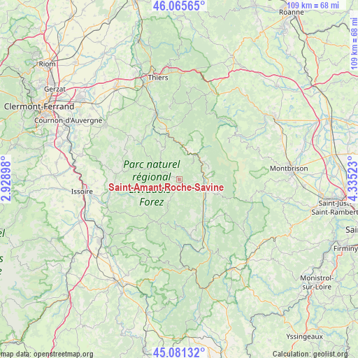
Saint-Amant-Roche-Savine GPS coordinates[2]
45° 34' 32.304" North, 3° 37' 55.56" East
| Map corner | latitude | longitude |
|---|---|---|
| Upper-left | 46.06565°, | 2.92898° |
| Center: | 45.57564°, | 3.6321° |
| Lower-right: | 45.08132°, | 4.33523° |
| Map W x H: | 109.4×109.4 km | = 68×68mi |
| max Lat: | 51.07786° ⇑73% North |
| Saint-Amant-Roche-Savine: | 45.57564° |
| min Lat: | ⇓27% South 41.3874° |
| min Long | Saint-Amant-Roc | max Long |
| -5.08615° | 3.6321° | 9.52242° |
| W 65.2%⇐ | ⇒34.8% E |
Elevation
Elevation of Saint-Amant-Roche-Savine is 887 m = 2910 ft, and this is 693.3 m = 2275 ft above average elevation for this country.
| Max E: |
2333 m = 7654 ft | 1.5% |
| Saint-Amant-Roche-Savine | 887 m 2910 ft | |
| Avg. | 193.7 m = 635 ft | |
Min E: |
-1 m = -3 ft | 98.5% |
See also: France elevation on elevation.city.
Geographical zone
Saint-Amant-Roche-Savine is located in North temperate zone (between Tropic of Cancer and the Arctic Circle). Distance of this North polar circle is 2333.6 km =1450 mi to North.| Distance of | km | miles | from Saint-Amant-Roche-Savine |
|---|---|---|---|
| North Pole | 4939.5 | 3069.3 | to North |
| Arctic Circle | 2333.6 | 1450 | to North |
| Tropic Cancer | 2461.6 | 1529.6 | to South |
| Equator | 5067.5 | 3148.8 | to South |


Nearby cities:
15 places around Saint-Amant-Roche-Savine: (largest is in red/bold)
• Ambert
9 km =5.6 mi,  108°
108°
• Augerolles
16.4 km =10.2 mi,  355°
355°
• Bertignat
6 km =3.7 mi,  39°
39°
• Cunlhat
8.4 km =5.2 mi,  317°
317°
• Fournols
7.3 km =4.5 mi,  207°
207°
• Job
9.9 km =6.2 mi,  62°
62°
• Marat
10.1 km =6.3 mi,  22°
22°
• Marsac-en-Livradois
13.1 km =8.1 mi,  145°
145°
• Montaigut
14.9 km =9.3 mi,  287°
287°
• Olliergues
11 km =6.8 mi,  1°
1°
• Saint-Dier-d’Auvergne
16.1 km =10 mi,  313°
313°
• Saint-Ferréol-des-Côtes
7.9 km =4.9 mi,  131°
131°
• Saint-Germain-l’Herm
14.8 km =9.2 mi, 208°
• Tours-sur-Meymont
11.6 km =7.2 mi,  337°
337°
• Vertolaye
10.1 km =6.3 mi, 35°
Sources, notices
• [Note1] Compared only with cities in France existing in our database
• [Src1] Map data: © OpenStreetMap contributors (CC-BY-SA)
• [Src2] Other city data from geonames.org with taken over terms of usage.
• [Src3] Geographical zone / Annual Mean Temperature by Robert A. Rohde @ Wikipedia
