Vertolaye geodata
Vertolaye (Auvergne-Rhône-Alpes) is a populated place; located in France in Europe/Paris (GMT+2) time zone. With population of 652 people, there are 12498 cities with bigger population in this country. Compared to other cities in France, 71.7% of cities are located further ↑North; 65.8% of cities are located further ←West and 94.1% of cities have lower elevation than Vertolaye. Note1
Administrative division(s):
- Level 1: Auvergne-Rhône-Alpes
- Level 2: Département du Puy-de-Dôme
- Level 3: Ambert
- Level 4: Vertolaye


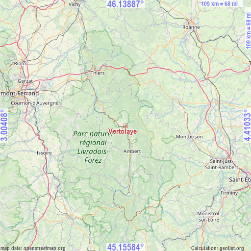
Vertolaye GPS coordinates[2]
45° 38' 58.236" North, 3° 42' 25.92" East
| Map corner | latitude | longitude |
|---|---|---|
| Upper-left | 46.13887°, | 3.00408° |
| Center: | 45.64951°, | 3.7072° |
| Lower-right: | 45.15584°, | 4.41033° |
| Map W x H: | 109.3×109.3 km | = 67.9×67.9mi |
| max Lat: | 51.07786° ⇑71.7% North |
| Vertolaye: | 45.64951° |
| min Lat: | ⇓28.3% South 41.3874° |
| min Long | Vertolaye | max Long |
| -5.08615° | 3.7072° | 9.52242° |
| W 65.8%⇐ | ⇒34.2% E |
Elevation
Elevation of Vertolaye is 544 m = 1785 ft, and this is 350.3 m = 1149 ft above average elevation for this country.
| Max E: |
2333 m = 7654 ft | 5.9% |
| Vertolaye | 544 m 1785 ft | |
| Avg. | 193.7 m = 635 ft | |
Min E: |
-1 m = -3 ft | 94.1% |
See also: France elevation on elevation.city.
Geographical zone
Vertolaye is located in North temperate zone (between Tropic of Cancer and the Arctic Circle). Distance of this North polar circle is 2325.4 km =1444.9 mi to North.| Distance of | km | miles | from Vertolaye |
|---|---|---|---|
| North Pole | 4931.3 | 3064.2 | to North |
| Arctic Circle | 2325.4 | 1444.9 | to North |
| Tropic Cancer | 2469.8 | 1534.7 | to South |
| Equator | 5075.7 | 3153.9 | to South |


Nearby cities:
15 places around Vertolaye: (largest is in red/bold)
• Ambert
11.4 km =7.1 mi,  166°
166°
• Augerolles
10.7 km =6.6 mi,  319°
319°
• Bertignat
4.1 km =2.5 mi,  210°
210°
• Courpière
17.5 km =10.9 mi,  312°
312°
• Cunlhat
11.7 km =7.3 mi,  260°
260°
• Fournols
17.4 km =10.8 mi, 212°
• Job
4.8 km =3 mi,  141°
141°
• Marat
2.2 km =1.4 mi,  299°
299°
• Olliergues
6.2 km =3.9 mi, 297°
• Saint-Amant-Roche-Savine
10.1 km =6.3 mi,  215°
215°
• Saint-Bonnet-le-Courreau
18.5 km =11.5 mi,  86°
86°
• Saint-Dier-d’Auvergne
17.7 km =11 mi,  279°
279°
• Saint-Ferréol-des-Côtes
13.5 km =8.4 mi,  179°
179°
• Tours-sur-Meymont
10.5 km =6.5 mi, 283°
• Vollore-Ville
17.2 km =10.7 mi,  331°
331°
Sources, notices
• [Note1] Compared only with cities in France existing in our database
• [Src1] Map data: © OpenStreetMap contributors (CC-BY-SA)
• [Src2] Other city data from geonames.org with taken over terms of usage.
• [Src3] Geographical zone / Annual Mean Temperature by Robert A. Rohde @ Wikipedia
