Saint-Alban-de-Roche geodata
Saint-Alban-de-Roche (Auvergne-Rhône-Alpes) is a populated place; located in France in Europe/Paris (GMT+2) time zone. With population of 1,855 people, there are 5114 cities with bigger population in this country. Compared to other cities in France, 72.7% of cities are located further ↑North; 80% of cities are located further ←West and 71.7% of cities have lower elevation than Saint-Alban-de-Roche. Note1
Administrative division(s):
- Level 1: Auvergne-Rhône-Alpes
- Level 2: Département de l'Isère
- Level 3: Arrondissement de La Tour-du-Pin
- Level 4: Saint-Alban-de-Roche


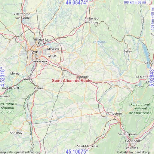
Saint-Alban-de-Roche GPS coordinates[2]
45° 35' 41.64" North, 5° 13' 34.68" East
| Map corner | latitude | longitude |
|---|---|---|
| Upper-left | 46.08474°, | 4.52318° |
| Center: | 45.5949°, | 5.2263° |
| Lower-right: | 45.10075°, | 5.92943° |
| Map W x H: | 109.4×109.4 km | = 68×68mi |
| max Lat: | 51.07786° ⇑72.7% North |
| Saint-Alban-de-Roche: | 45.5949° |
| min Lat: | ⇓27.3% South 41.3874° |
| min Long | Saint-Alban-de- | max Long |
| -5.08615° | 5.2263° | 9.52242° |
| W 80%⇐ | ⇒20% E |
Elevation
Elevation of Saint-Alban-de-Roche is 228 m = 748 ft, and this is 34.3 m = 113 ft above average elevation for this country.
| Max E: |
2333 m = 7654 ft | 28.3% |
| Saint-Alban-de-Roche | 228 m 748 ft | |
| Avg. | 193.7 m = 635 ft | |
Min E: |
-1 m = -3 ft | 71.7% |
See also: France elevation on elevation.city.
Geographical zone
Saint-Alban-de-Roche is located in North temperate zone (between Tropic of Cancer and the Arctic Circle). Distance of this North polar circle is 2331.5 km =1448.7 mi to North.| Distance of | km | miles | from Saint-Alban-de-Roche |
|---|---|---|---|
| North Pole | 4937.4 | 3068 | to North |
| Arctic Circle | 2331.5 | 1448.7 | to North |
| Tropic Cancer | 2463.8 | 1530.9 | to South |
| Equator | 5069.7 | 3150.2 | to South |


Nearby cities:
15 places around Saint-Alban-de-Roche: (largest is in red/bold)
• Bourgoin-Jallieu
3.8 km =2.4 mi,  104°
104°
• Domarin
1.8 km =1.1 mi,  121°
121°
• Four
2.7 km =1.7 mi,  250°
250°
• Frontonas
6 km =3.7 mi,  337°
337°
• La Verpillière
7.6 km =4.7 mi,  304°
304°
• L’Isle-d’Abeau
2.7 km =1.7 mi,  357°
357°
• Maubec
4.2 km =2.6 mi,  136°
136°
• Meyrié
6.3 km =3.9 mi,  130°
130°
• Nivolas-Vermelle
7.4 km =4.6 mi, 122°
• Roche
5.1 km =3.2 mi,  260°
260°
• Ruy
7.5 km =4.7 mi, 97°
• Saint-Agnin-sur-Bion
6.2 km =3.9 mi,  172°
172°
• Saint-Savin
7.4 km =4.6 mi,  60°
60°
• Vaulx-Milieu
3.9 km =2.4 mi, 301°
• Villefontaine
6.2 km =3.9 mi,  288°
288°
Sources, notices
• [Note1] Compared only with cities in France existing in our database
• [Src1] Map data: © OpenStreetMap contributors (CC-BY-SA)
• [Src2] Other city data from geonames.org with taken over terms of usage.
• [Src3] Geographical zone / Annual Mean Temperature by Robert A. Rohde @ Wikipedia
