Rugles geodata
Rugles (Normandy) is a populated place; located in France in Europe/Paris (GMT+2) time zone. With population of 2,697 people, there are 3621 cities with bigger population in this country. Compared to other cities in France, 76% of cities are located further ↓South; 71.3% of cities are located further →East and 62.4% of cities have lower elevation than Rugles. Note1
Administrative division(s):
- Level 1: Normandy
- Level 2: Département de l'Eure
- Level 3: Arrondissement de Bernay
- Level 4: Rugles


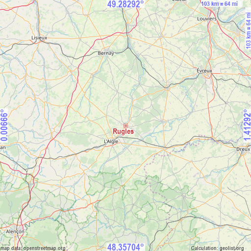
Rugles GPS coordinates[2]
48° 49' 19.632" North, 0° 42' 35.244" East
| Map corner | latitude | longitude |
|---|---|---|
| Upper-left | 49.28292°, | 0.00666° |
| Center: | 48.82212°, | 0.70979° |
| Lower-right: | 48.35704°, | 1.41292° |
| Map W x H: | 102.9×102.9 km | = 63.9×63.9mi |
| max Lat: | 51.07786° ⇑24% North |
| Rugles: | 48.82212° |
| min Lat: | ⇓76% South 41.3874° |
| min Long | Rugles | max Long |
| -5.08615° | 0.70979° | 9.52242° |
| W 28.7%⇐ | ⇒71.3% E |
Elevation
Elevation of Rugles is 181 m = 594 ft, and this is 12.7 m = 42 ft below average elevation for this country.
| Max E: |
2333 m = 7654 ft | 37.6% |
| Avg. | 193.7 m = 635 ft | |
| Rugles | 181 m = 594 ft | |
Min E: |
-1 m = -3 ft | 62.4% |
See also: France elevation on elevation.city.
Geographical zone
Rugles is located in North temperate zone (between Tropic of Cancer and the Arctic Circle). Distance of this North polar circle is 1972.7 km =1225.8 mi to North.| Distance of | km | miles | from Rugles |
|---|---|---|---|
| North Pole | 4578.6 | 2845 | to North |
| Arctic Circle | 1972.7 | 1225.8 | to North |
| Tropic Cancer | 2822.6 | 1753.9 | to South |
| Equator | 5428.5 | 3373.1 | to South |


Nearby cities:
15 places around Rugles: (largest is in red/bold)
• Bois-Arnault
1.7 km =1.1 mi,  118°
118°
• Bourth
9.4 km =5.8 mi,  129°
129°
• Chandai
8 km =5 mi,  163°
163°
• Crulai
13.5 km =8.4 mi,  193°
193°
• Francheville
11 km =6.8 mi,  111°
111°
• Glos-la-Ferrière
8.8 km =5.5 mi,  295°
295°
• La Barre-en-Ouche
14.2 km =8.8 mi,  346°
346°
• La Guéroulde
13.2 km =8.2 mi,  94°
94°
• La Neuve-Lyre
9.9 km =6.2 mi,  15°
15°
• La Vieille-Lyre
10.9 km =6.8 mi, 15°
• Les Baux-de-Breteuil
9.8 km =6.1 mi,  49°
49°
• Rai
12.3 km =7.6 mi,  229°
229°
• Saint-Ouen-sur-Iton
9.7 km =6 mi, 185°
• Saint-Sulpice-sur-Risle
6 km =3.7 mi,  219°
219°
• Saint-Symphorien-des-Bruyères
10.1 km =6.3 mi,  248°
248°
Sources, notices
• [Note1] Compared only with cities in France existing in our database
• [Src1] Map data: © OpenStreetMap contributors (CC-BY-SA)
• [Src2] Other city data from geonames.org with taken over terms of usage.
• [Src3] Geographical zone / Annual Mean Temperature by Robert A. Rohde @ Wikipedia
