Rai geodata
Rai (Normandy) is a populated place; located in France in Europe/Paris (GMT+2) time zone. With population of 1,790 people, there are 5304 cities with bigger population in this country. Compared to other cities in France, 74.3% of cities are located further ↓South; 72.6% of cities are located further →East and 68.1% of cities have lower elevation than Rai. Note1
Administrative division(s):
- Level 1: Normandy
- Level 2: Département de l'Orne
- Level 3: Arrondissement de Mortagne-au-Perche
- Level 4: Rai


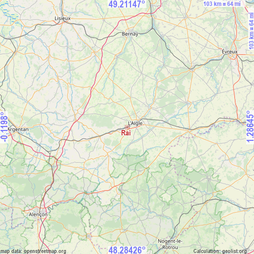
Rai GPS coordinates[2]
48° 45' 0" North, 0° 34' 59.988" East
| Map corner | latitude | longitude |
|---|---|---|
| Upper-left | 49.21147°, | -0.1198° |
| Center: | 48.75°, | 0.58333° |
| Lower-right: | 48.28426°, | 1.28645° |
| Map W x H: | 103.1×103.1 km | = 64.1×64.1mi |
| max Lat: | 51.07786° ⇑25.7% North |
| Rai: | 48.75° |
| min Lat: | ⇓74.3% South 41.3874° |
| min Long | Rai | max Long |
| -5.08615° | 0.58333° | 9.52242° |
| W 27.4%⇐ | ⇒72.6% E |
Elevation
Elevation of Rai is 210 m = 689 ft, and this is 16.3 m = 53 ft above average elevation for this country.
| Max E: |
2333 m = 7654 ft | 31.9% |
| Rai | 210 m 689 ft | |
| Avg. | 193.7 m = 635 ft | |
Min E: |
-1 m = -3 ft | 68.1% |
See also: France elevation on elevation.city.
Geographical zone
Rai is located in North temperate zone (between Tropic of Cancer and the Arctic Circle). Distance of this North polar circle is 1980.7 km =1230.7 mi to North.| Distance of | km | miles | from Rai |
|---|---|---|---|
| North Pole | 4586.6 | 2850 | to North |
| Arctic Circle | 1980.7 | 1230.7 | to North |
| Tropic Cancer | 2814.6 | 1748.9 | to South |
| Equator | 5420.5 | 3368.1 | to South |


Nearby cities:
15 places around Rai: (largest is in red/bold)
• Aube-sur-Rîle
2.6 km =1.6 mi,  242°
242°
• Bois-Arnault
13 km =8.1 mi,  56°
56°
• Chandai
11.5 km =7.1 mi,  88°
88°
• Crulai
8 km =5 mi,  129°
129°
• Glos-la-Ferrière
12 km =7.5 mi,  6°
6°
• La Ferté-Frênel
11.5 km =7.1 mi,  332°
332°
• Moulins-la-Marche
13.5 km =8.4 mi,  215°
215°
• Randonnai
13.1 km =8.1 mi,  148°
148°
• Rugles
12.3 km =7.6 mi,  49°
49°
• Saint-Ouen-sur-Iton
8.4 km =5.2 mi,  101°
101°
• Saint-Sulpice-sur-Risle
6.4 km =4 mi, 57°
• Saint-Symphorien-des-Bruyères
4.3 km =2.7 mi,  358°
358°
• Sainte-Gauburge-Sainte-Colombe
11.7 km =7.3 mi,  251°
251°
• Soligny-la-Trappe
15.5 km =9.6 mi,  193°
193°
• Échauffour
14.4 km =8.9 mi,  265°
265°
Sources, notices
• [Note1] Compared only with cities in France existing in our database
• [Src1] Map data: © OpenStreetMap contributors (CC-BY-SA)
• [Src2] Other city data from geonames.org with taken over terms of usage.
• [Src3] Geographical zone / Annual Mean Temperature by Robert A. Rohde @ Wikipedia
