Hatrize geodata
Hatrize (Grand Est) is a populated place; located in France in Europe/Paris (GMT+2) time zone. With population of 708 people, there are 11684 cities with bigger population in this country. Compared to other cities in France, 84.1% of cities are located further ↓South; 86% of cities are located further ←West and 68.1% of cities have lower elevation than Hatrize. Note1
Administrative division(s):
- Level 1: Grand Est
- Level 2: Meurthe-et-Moselle
- Level 3: Arrondissement de Briey
- Level 4: Hatrize


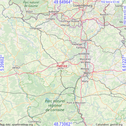
Hatrize GPS coordinates[2]
49° 11' 32.136" North, 5° 54' 32.904" East
| Map corner | latitude | longitude |
|---|---|---|
| Upper-left | 49.64964°, | 5.20602° |
| Center: | 49.19226°, | 5.90914° |
| Lower-right: | 48.73062°, | 6.61227° |
| Map W x H: | 102.2×102.2 km | = 63.5×63.5mi |
| max Lat: | 51.07786° ⇑15.9% North |
| Hatrize: | 49.19226° |
| min Lat: | ⇓84.1% South 41.3874° |
| min Long | Hatrize | max Long |
| -5.08615° | 5.90914° | 9.52242° |
| W 86%⇐ | ⇒14% E |
Elevation
Elevation of Hatrize is 210 m = 689 ft, and this is 16.3 m = 53 ft above average elevation for this country.
| Max E: |
2333 m = 7654 ft | 31.9% |
| Hatrize | 210 m 689 ft | |
| Avg. | 193.7 m = 635 ft | |
Min E: |
-1 m = -3 ft | 68.1% |
See also: France elevation on elevation.city.
Geographical zone
Hatrize is located in North temperate zone (between Tropic of Cancer and the Arctic Circle). Distance of this North polar circle is 1931.5 km =1200.2 mi to North.| Distance of | km | miles | from Hatrize |
|---|---|---|---|
| North Pole | 4537.4 | 2819.4 | to North |
| Arctic Circle | 1931.5 | 1200.2 | to North |
| Tropic Cancer | 2863.7 | 1779.4 | to South |
| Equator | 5469.7 | 3398.7 | to South |


Nearby cities:
15 places around Hatrize: (largest is in red/bold)
• Auboué
5.4 km =3.4 mi,  65°
65°
• Batilly
4.8 km =3 mi,  115°
115°
• Briey
6.7 km =4.2 mi,  19°
19°
• Conflans-en-Jarnisy
4.8 km =3 mi,  234°
234°
• Doncourt-lès-Conflans
5.8 km =3.6 mi,  162°
162°
• Giraumont
2.4 km =1.5 mi,  170°
170°
• Homécourt
6.8 km =4.2 mi,  62°
62°
• Jarny
4.4 km =2.7 mi,  212°
212°
• Labry
3 km =1.9 mi,  223°
223°
• Lantéfontaine
6.3 km =3.9 mi,  357°
357°
• Mance
8.5 km =5.3 mi,  3°
3°
• Moineville
2.9 km =1.8 mi, 60°
• Moutiers
6.1 km =3.8 mi,  42°
42°
• Sainte-Marie-aux-Chênes
6.7 km =4.2 mi,  89°
89°
• Valleroy
2.8 km =1.7 mi,  46°
46°
Sources, notices
• [Note1] Compared only with cities in France existing in our database
• [Src1] Map data: © OpenStreetMap contributors (CC-BY-SA)
• [Src2] Other city data from geonames.org with taken over terms of usage.
• [Src3] Geographical zone / Annual Mean Temperature by Robert A. Rohde @ Wikipedia
