Rosbruck geodata
Rosbruck (Grand Est) is a populated place; located in France in Europe/Paris (GMT+2) time zone. With population of 940 people, there are 9303 cities with bigger population in this country. Compared to other cities in France, 83.5% of cities are located further ↓South; 93.9% of cities are located further ←West and 68.1% of cities have lower elevation than Rosbruck. Note1
Administrative division(s):
- Level 1: Grand Est
- Level 2: Moselle
- Level 3: Arrondissement de Forbach-Boulay-Moselle
- Level 4: Rosbruck


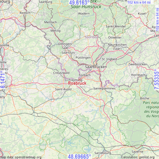
Rosbruck GPS coordinates[2]
49° 9' 30.996" North, 6° 51' 0.792" East
| Map corner | latitude | longitude |
|---|---|---|
| Upper-left | 49.6163°, | 6.1471° |
| Center: | 49.15861°, | 6.85022° |
| Lower-right: | 48.69665°, | 7.55335° |
| Map W x H: | 102.3×102.3 km | = 63.6×63.6mi |
| max Lat: | 51.07786° ⇑16.5% North |
| Rosbruck: | 49.15861° |
| min Lat: | ⇓83.5% South 41.3874° |
| min Long | Rosbruck | max Long |
| -5.08615° | 6.85022° | 9.52242° |
| W 93.9%⇐ | ⇒6.1% E |
Elevation
Elevation of Rosbruck is 210 m = 689 ft, and this is 16.3 m = 53 ft above average elevation for this country.
| Max E: |
2333 m = 7654 ft | 31.9% |
| Rosbruck | 210 m 689 ft | |
| Avg. | 193.7 m = 635 ft | |
Min E: |
-1 m = -3 ft | 68.1% |
See also: France elevation on elevation.city.
Geographical zone
Rosbruck is located in North temperate zone (between Tropic of Cancer and the Arctic Circle). Distance of this North polar circle is 1935.2 km =1202.5 mi to North.| Distance of | km | miles | from Rosbruck |
|---|---|---|---|
| North Pole | 4541.1 | 2821.7 | to North |
| Arctic Circle | 1935.2 | 1202.5 | to North |
| Tropic Cancer | 2860 | 1777.1 | to South |
| Equator | 5465.9 | 3396.4 | to South |


Nearby cities:
15 places around Rosbruck: (largest is in red/bold)
• Behren-lès-Forbach
6.6 km =4.1 mi,  79°
79°
• Betting
4.3 km =2.7 mi,  214°
214°
• Béning-lès-Saint-Avold
2.7 km =1.7 mi,  197°
197°
• Cocheren
1.7 km =1.1 mi,  164°
164°
• Farébersviller
4.6 km =2.9 mi, 162°
• Folkling
3.5 km =2.2 mi,  110°
110°
• Forbach
4.5 km =2.8 mi,  42°
42°
• Freyming-Merlebach
5 km =3.1 mi,  258°
258°
• Henriville
6.7 km =4.2 mi,  176°
176°
• Hombourg-Haut
6.7 km =4.2 mi,  239°
239°
• Morsbach
1.9 km =1.2 mi,  56°
56°
• Petite-Rosselle
5.9 km =3.7 mi,  4°
4°
• Seingbouse
5.2 km =3.2 mi,  194°
194°
• Théding
4.5 km =2.8 mi,  137°
137°
• Œting
5 km =3.1 mi,  71°
71°
Sources, notices
• [Note1] Compared only with cities in France existing in our database
• [Src1] Map data: © OpenStreetMap contributors (CC-BY-SA)
• [Src2] Other city data from geonames.org with taken over terms of usage.
• [Src3] Geographical zone / Annual Mean Temperature by Robert A. Rohde @ Wikipedia
