Petite-Rosselle geodata
Petite-Rosselle (Grand Est) is a populated place; located in France in Europe/Paris (GMT+2) time zone. With population of 6,973 people, there are 1413 cities with bigger population in this country. Compared to other cities in France, 84.5% of cities are located further ↓South; 94% of cities are located further ←West and 74.4% of cities have lower elevation than Petite-Rosselle. Note1
Administrative division(s):
- Level 1: Grand Est
- Level 2: Moselle
- Level 3: Arrondissement de Forbach-Boulay-Moselle
- Level 4: Petite-Rosselle


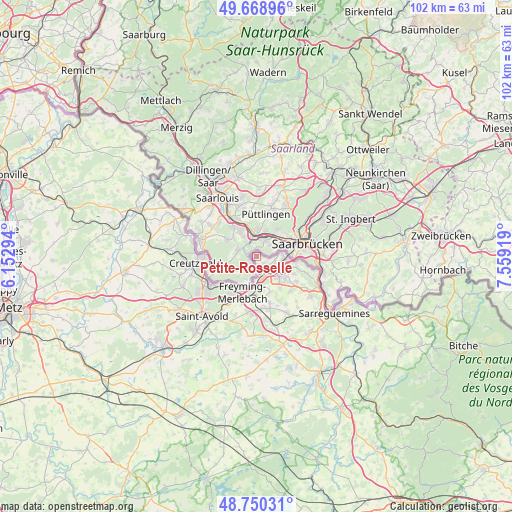
Petite-Rosselle GPS coordinates[2]
49° 12' 42.372" North, 6° 51' 21.852" East
| Map corner | latitude | longitude |
|---|---|---|
| Upper-left | 49.66896°, | 6.15294° |
| Center: | 49.21177°, | 6.85607° |
| Lower-right: | 48.75031°, | 7.55919° |
| Map W x H: | 102.1×102.1 km | = 63.4×63.4mi |
| max Lat: | 51.07786° ⇑15.5% North |
| Petite-Rosselle: | 49.21177° |
| min Lat: | ⇓84.5% South 41.3874° |
| min Long | Petite-Rosselle | max Long |
| -5.08615° | 6.85607° | 9.52242° |
| W 94%⇐ | ⇒6% E |
Elevation
Elevation of Petite-Rosselle is 245 m = 804 ft, and this is 51.3 m = 168 ft above average elevation for this country.
| Max E: |
2333 m = 7654 ft | 25.6% |
| Petite-Rosselle | 245 m 804 ft | |
| Avg. | 193.7 m = 635 ft | |
Min E: |
-1 m = -3 ft | 74.4% |
See also: France elevation on elevation.city.
Geographical zone
Petite-Rosselle is located in North temperate zone (between Tropic of Cancer and the Arctic Circle). Distance of this North polar circle is 1929.3 km =1198.8 mi to North.| Distance of | km | miles | from Petite-Rosselle |
|---|---|---|---|
| North Pole | 4535.2 | 2818 | to North |
| Arctic Circle | 1929.3 | 1198.8 | to North |
| Tropic Cancer | 2865.9 | 1780.8 | to South |
| Equator | 5471.8 | 3400 | to South |


Nearby cities:
15 places around Petite-Rosselle: (largest is in red/bold)
• Behren-lès-Forbach
7.7 km =4.8 mi,  127°
127°
• Béning-lès-Saint-Avold
8.6 km =5.3 mi,  188°
188°
• Cocheren
7.6 km =4.7 mi,  179°
179°
• Etzling
8.3 km =5.2 mi,  115°
115°
• Folkling
7.7 km =4.8 mi,  158°
158°
• Forbach
3.7 km =2.3 mi, 134°
• Freyming-Merlebach
8.7 km =5.4 mi,  217°
217°
• Kerbach
9.4 km =5.8 mi, 122°
• Morsbach
5 km =3.1 mi,  166°
166°
• Rosbruck
5.9 km =3.7 mi, 184°
• Schœneck
4.4 km =2.7 mi,  82°
82°
• Spicheren
8.3 km =5.2 mi,  104°
104°
• Stiring-Wendel
5.6 km =3.5 mi, 101°
• Théding
9.6 km =6 mi, 164°
• Œting
6.1 km =3.8 mi,  135°
135°
Sources, notices
• [Note1] Compared only with cities in France existing in our database
• [Src1] Map data: © OpenStreetMap contributors (CC-BY-SA)
• [Src2] Other city data from geonames.org with taken over terms of usage.
• [Src3] Geographical zone / Annual Mean Temperature by Robert A. Rohde @ Wikipedia
