Rioux geodata
Rioux (Nouvelle-Aquitaine) is a populated place; located in France in Europe/Paris (GMT+2) time zone. With population of 829 people, there are 10301 cities with bigger population in this country. Compared to other cities in France, 71.9% of cities are located further ↑North; 85.6% of cities are located further →East and 84.5% of cities have higher elevation than Rioux. Note1
Administrative division(s):
- Level 1: Nouvelle-Aquitaine
- Level 2: Charente-Maritime
- Level 3: Arrondissement de Saintes
- Level 4: Rioux


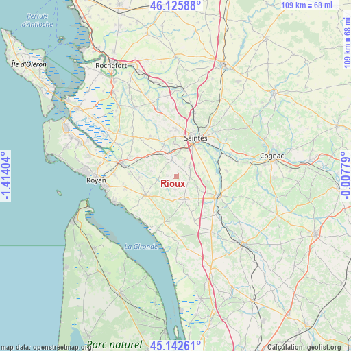
Rioux GPS coordinates[2]
45° 38' 11.04" North, 0° 42' 39.312" West
| Map corner | latitude | longitude |
|---|---|---|
| Upper-left | 46.12588°, | -1.41404° |
| Center: | 45.6364°, | -0.71092° |
| Lower-right: | 45.14261°, | -0.00779° |
| Map W x H: | 109.3×109.3 km | = 67.9×67.9mi |
| max Lat: | 51.07786° ⇑71.9% North |
| Rioux: | 45.6364° |
| min Lat: | ⇓28.1% South 41.3874° |
| min Long | Rioux | max Long |
| -5.08615° | -0.71092° | 9.52242° |
| W 14.4%⇐ | ⇒85.6% E |
Elevation
Elevation of Rioux is 43 m = 141 ft, and this is 150.7 m = 494 ft below average elevation for this country.
| Max E: |
2333 m = 7654 ft | 84.5% |
| Avg. | 193.7 m = 635 ft | |
| Rioux | 43 m = 141 ft | |
Min E: |
-1 m = -3 ft | 15.5% |
See also: France elevation on elevation.city.
Geographical zone
Rioux is located in North temperate zone (between Tropic of Cancer and the Arctic Circle). Distance of this North polar circle is 2326.9 km =1445.9 mi to North.| Distance of | km | miles | from Rioux |
|---|---|---|---|
| North Pole | 4932.8 | 3065.1 | to North |
| Arctic Circle | 2326.9 | 1445.9 | to North |
| Tropic Cancer | 2468.4 | 1533.8 | to South |
| Equator | 5074.3 | 3153 | to South |


Nearby cities:
15 places around Rioux: (largest is in red/bold)
• Chermignac
6.2 km =3.9 mi,  27°
27°
• Corme-Écluse
11.4 km =7.1 mi,  266°
266°
• Cozes
11.1 km =6.9 mi,  238°
238°
• Cravans
4.4 km =2.7 mi,  179°
179°
• Grézac
10.7 km =6.6 mi,  250°
250°
• Gémozac
8 km =5 mi,  159°
159°
• Meursac
7.7 km =4.8 mi,  280°
280°
• Montpellier-de-Médillan
2.6 km =1.6 mi, 265°
• Pessines
10.1 km =6.3 mi,  357°
357°
• Rétaud
4.8 km =3 mi,  344°
344°
• Saint-André-de-Lidon
5 km =3.1 mi,  215°
215°
• Saint-Léger
10 km =6.2 mi,  99°
99°
• Tesson
4.6 km =2.9 mi, 95°
• Thénac
5.6 km =3.5 mi,  52°
52°
• Varzay
7.9 km =4.9 mi,  348°
348°
Sources, notices
• [Note1] Compared only with cities in France existing in our database
• [Src1] Map data: © OpenStreetMap contributors (CC-BY-SA)
• [Src2] Other city data from geonames.org with taken over terms of usage.
• [Src3] Geographical zone / Annual Mean Temperature by Robert A. Rohde @ Wikipedia
