Riotord geodata
Riotord (Auvergne-Rhône-Alpes) is a populated place; located in France in Europe/Paris (GMT+2) time zone. With population of 1,210 people, there are 7474 cities with bigger population in this country. Compared to other cities in France, 77.1% of cities are located further ↑North; 71.4% of cities are located further ←West and 98.9% of cities have lower elevation than Riotord. Note1
Administrative division(s):
- Level 1: Auvergne-Rhône-Alpes
- Level 2: Haute-Loire
- Level 3: Yssingeaux
- Level 4: Riotord


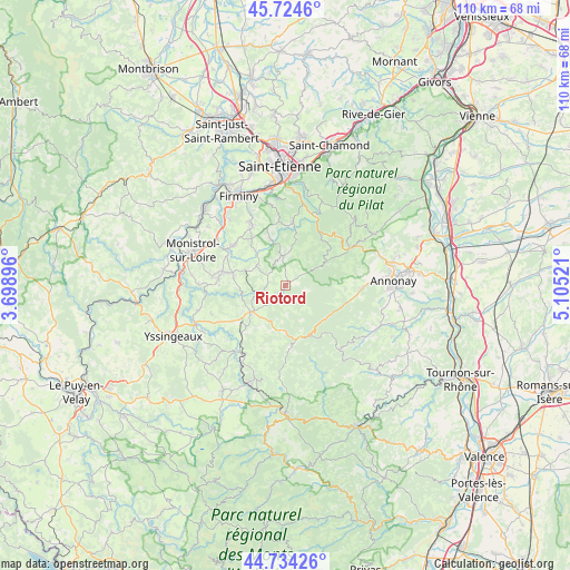
Riotord GPS coordinates[2]
45° 13' 53.724" North, 4° 24' 7.488" East
| Map corner | latitude | longitude |
|---|---|---|
| Upper-left | 45.7246°, | 3.69896° |
| Center: | 45.23159°, | 4.40208° |
| Lower-right: | 44.73426°, | 5.10521° |
| Map W x H: | 110.1×110.1 km | = 68.4×68.4mi |
| max Lat: | 51.07786° ⇑77.1% North |
| Riotord: | 45.23159° |
| min Lat: | ⇓22.9% South 41.3874° |
| min Long | Riotord | max Long |
| -5.08615° | 4.40208° | 9.52242° |
| W 71.4%⇐ | ⇒28.6% E |
Elevation
Elevation of Riotord is 943 m = 3094 ft, and this is 749.3 m = 2458 ft above average elevation for this country.
| Max E: |
2333 m = 7654 ft | 1.1% |
| Riotord | 943 m 3094 ft | |
| Avg. | 193.7 m = 635 ft | |
Min E: |
-1 m = -3 ft | 98.9% |
See also: France elevation on elevation.city.
Geographical zone
Riotord is located in North temperate zone (between Tropic of Cancer and the Arctic Circle). Distance of this North polar circle is 2371.9 km =1473.8 mi to North.| Distance of | km | miles | from Riotord |
|---|---|---|---|
| North Pole | 4977.8 | 3093.1 | to North |
| Arctic Circle | 2371.9 | 1473.8 | to North |
| Tropic Cancer | 2423.4 | 1505.8 | to South |
| Equator | 5029.3 | 3125.1 | to South |


Nearby cities:
15 places around Riotord: (largest is in red/bold)
• Dunières
4.8 km =3 mi,  248°
248°
• Jonzieux
9.6 km =6 mi,  340°
340°
• Marlhes
5.7 km =3.5 mi,  355°
355°
• Montfaucon-en-Velay
8.6 km =5.3 mi,  233°
233°
• Montregard
9.2 km =5.7 mi,  208°
208°
• Raucoules
9.7 km =6 mi,  239°
239°
• Saint-Didier-en-Velay
12.7 km =7.9 mi,  308°
308°
• Saint-Genest-Malifaux
12.2 km =7.6 mi,  5°
5°
• Saint-Pal-de-Mons
10.1 km =6.3 mi,  279°
279°
• Saint-Romain-Lachalm
6.6 km =4.1 mi, 305°
• Saint-Sauveur-en-Rue
8.4 km =5.2 mi,  59°
59°
• Saint-Victor-Malescours
9.7 km =6 mi, 313°
• Sainte-Sigolène
13.3 km =8.3 mi, 275°
• Vanosc
11.6 km =7.2 mi,  93°
93°
• Vocance
12.3 km =7.6 mi,  105°
105°
Sources, notices
• [Note1] Compared only with cities in France existing in our database
• [Src1] Map data: © OpenStreetMap contributors (CC-BY-SA)
• [Src2] Other city data from geonames.org with taken over terms of usage.
• [Src3] Geographical zone / Annual Mean Temperature by Robert A. Rohde @ Wikipedia
