Dunières geodata
Dunières (Auvergne-Rhône-Alpes) is a populated place; located in France in Europe/Paris (GMT+2) time zone. With population of 3,016 people, there are 3232 cities with bigger population in this country. Compared to other cities in France, 77.3% of cities are located further ↑North; 70.9% of cities are located further ←West and 97.8% of cities have lower elevation than Dunières. Note1
Administrative division(s):
- Level 1: Auvergne-Rhône-Alpes
- Level 2: Haute-Loire
- Level 3: Yssingeaux
- Level 4: Dunières


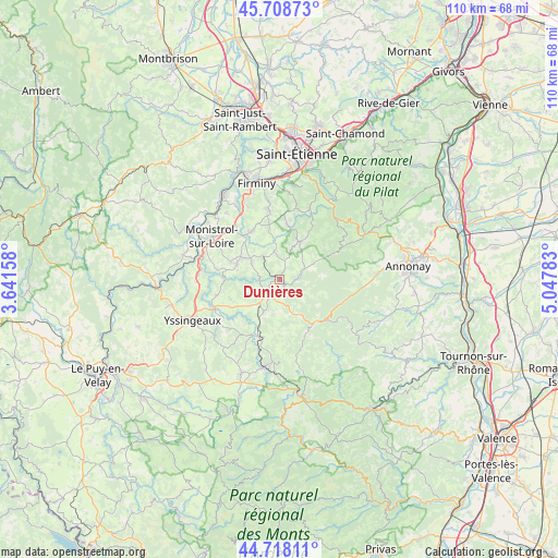
Dunières GPS coordinates[2]
45° 12' 56.088" North, 4° 20' 40.956" East
| Map corner | latitude | longitude |
|---|---|---|
| Upper-left | 45.70873°, | 3.64158° |
| Center: | 45.21558°, | 4.34471° |
| Lower-right: | 44.71811°, | 5.04783° |
| Map W x H: | 110.1×110.1 km | = 68.4×68.4mi |
| max Lat: | 51.07786° ⇑77.3% North |
| Dunières: | 45.21558° |
| min Lat: | ⇓22.7% South 41.3874° |
| min Long | Dunières | max Long |
| -5.08615° | 4.34471° | 9.52242° |
| W 70.9%⇐ | ⇒29.1% E |
Elevation
Elevation of Dunières is 798 m = 2618 ft, and this is 604.3 m = 1983 ft above average elevation for this country.
| Max E: |
2333 m = 7654 ft | 2.2% |
| Dunières | 798 m 2618 ft | |
| Avg. | 193.7 m = 635 ft | |
Min E: |
-1 m = -3 ft | 97.8% |
See also: France elevation on elevation.city.
Geographical zone
Dunières is located in North temperate zone (between Tropic of Cancer and the Arctic Circle). Distance of this North polar circle is 2373.7 km =1474.9 mi to North.| Distance of | km | miles | from Dunières |
|---|---|---|---|
| North Pole | 4979.6 | 3094.2 | to North |
| Arctic Circle | 2373.7 | 1474.9 | to North |
| Tropic Cancer | 2421.6 | 1504.7 | to South |
| Equator | 5027.5 | 3123.9 | to South |


Nearby cities:
15 places around Dunières: (largest is in red/bold)
• Jonzieux
11 km =6.8 mi,  6°
6°
• La Séauve-sur-Semène
11.6 km =7.2 mi,  320°
320°
• Lapte
10.5 km =6.5 mi,  251°
251°
• Les Villettes
12.8 km =8 mi,  279°
279°
• Marlhes
8.5 km =5.3 mi,  28°
28°
• Montfaucon-en-Velay
4.1 km =2.5 mi,  216°
216°
• Montregard
6.3 km =3.9 mi,  178°
178°
• Raucoules
5 km =3.1 mi,  231°
231°
• Riotord
4.8 km =3 mi,  68°
68°
• Saint-Didier-en-Velay
11.1 km =6.9 mi,  330°
330°
• Saint-Pal-de-Mons
6.5 km =4 mi,  301°
301°
• Saint-Romain-Lachalm
5.7 km =3.5 mi,  351°
351°
• Saint-Victor-Malescours
8.8 km =5.5 mi,  343°
343°
• Sainte-Sigolène
9.2 km =5.7 mi,  289°
289°
• Tence
12 km =7.5 mi,  200°
200°
Sources, notices
• [Note1] Compared only with cities in France existing in our database
• [Src1] Map data: © OpenStreetMap contributors (CC-BY-SA)
• [Src2] Other city data from geonames.org with taken over terms of usage.
• [Src3] Geographical zone / Annual Mean Temperature by Robert A. Rohde @ Wikipedia
