Quiévy geodata
Quiévy (Hauts-de-France) is a populated place; located in France in Europe/Paris (GMT+2) time zone. With population of 1,757 people, there are 5389 cities with bigger population in this country. Compared to other cities in France, 94.7% of cities are located further ↓South; 63.5% of cities are located further ←West and 67.8% of cities have higher elevation than Quiévy. Note1
Administrative division(s):
- Level 1: Hauts-de-France
- Level 2: Nord
- Level 3: Arrondissement de Cambrai
- Level 4: Quiévy


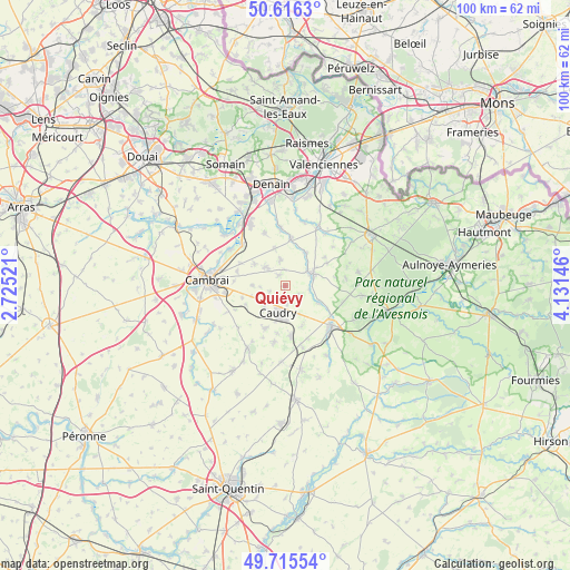
Quiévy GPS coordinates[2]
50° 10' 4.944" North, 3° 25' 42.024" East
| Map corner | latitude | longitude |
|---|---|---|
| Upper-left | 50.6163°, | 2.72521° |
| Center: | 50.16804°, | 3.42834° |
| Lower-right: | 49.71554°, | 4.13146° |
| Map W x H: | 100.2×100.2 km | = 62.3×62.3mi |
| max Lat: | 51.07786° ⇑5.3% North |
| Quiévy: | 50.16804° |
| min Lat: | ⇓94.7% South 41.3874° |
| min Long | Quiévy | max Long |
| -5.08615° | 3.42834° | 9.52242° |
| W 63.5%⇐ | ⇒36.5% E |
Elevation
Elevation of Quiévy is 83 m = 272 ft, and this is 110.7 m = 363 ft below average elevation for this country.
| Max E: |
2333 m = 7654 ft | 67.8% |
| Avg. | 193.7 m = 635 ft | |
| Quiévy | 83 m = 272 ft | |
Min E: |
-1 m = -3 ft | 32.2% |
See also: France elevation on elevation.city.
Geographical zone
Quiévy is located in North temperate zone (between Tropic of Cancer and the Arctic Circle). Distance of this North polar circle is 1823 km =1132.8 mi to North.| Distance of | km | miles | from Quiévy |
|---|---|---|---|
| North Pole | 4428.9 | 2752 | to North |
| Arctic Circle | 1823 | 1132.8 | to North |
| Tropic Cancer | 2972.2 | 1846.8 | to South |
| Equator | 5578.2 | 3466.1 | to South |


Nearby cities:
15 places around Quiévy: (largest is in red/bold)
• Avesnes-les-Aubert
4.8 km =3 mi,  317°
317°
• Beauvois-en-Cambrésis
4.9 km =3 mi,  226°
226°
• Briastre
4.1 km =2.5 mi,  100°
100°
• Béthencourt
3.5 km =2.2 mi,  174°
174°
• Bévillers
3 km =1.9 mi,  246°
246°
• Carnières
5.8 km =3.6 mi,  270°
270°
• Caudry
4.9 km =3 mi,  193°
193°
• Fontaine-au-Pire
5.4 km =3.4 mi,  222°
222°
• Inchy
5.7 km =3.5 mi,  153°
153°
• Saint-Aubert
4.5 km =2.8 mi,  349°
349°
• Saint-Hilaire-lez-Cambrai
2.1 km =1.3 mi,  329°
329°
• Saint-Python
4.4 km =2.7 mi,  56°
56°
• Saint-Vaast-en-Cambrésis
3.6 km =2.2 mi, 346°
• Solesmes
5.3 km =3.3 mi,  69°
69°
• Viesly
2.9 km =1.8 mi,  123°
123°
Sources, notices
• [Note1] Compared only with cities in France existing in our database
• [Src1] Map data: © OpenStreetMap contributors (CC-BY-SA)
• [Src2] Other city data from geonames.org with taken over terms of usage.
• [Src3] Geographical zone / Annual Mean Temperature by Robert A. Rohde @ Wikipedia
