Grandrieu geodata
Grandrieu (Occitanie) is a populated place; located in France in Europe/Paris (GMT+1) time zone. With population of 818 people, there are 10409 cities with bigger population in this country. Compared to other cities in France, 81.5% of cities are located further ↑North; 65.3% of cities are located further ←West and 99.6% of cities have lower elevation than Grandrieu. Note1
Administrative division(s):
- Level 1: Occitanie
- Level 2: Département de la Lozère
- Level 3: Arrondissement de Mende
- Level 4: Grandrieu


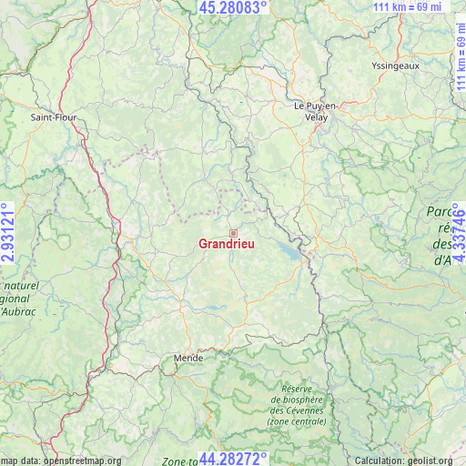
Grandrieu GPS coordinates[2]
44° 47' 2.148" North, 3° 38' 3.588" East
| Map corner | latitude | longitude |
|---|---|---|
| Upper-left | 45.28083°, | 2.93121° |
| Center: | 44.78393°, | 3.63433° |
| Lower-right: | 44.28272°, | 4.33746° |
| Map W x H: | 111×111 km | = 69×69mi |
| max Lat: | 51.07786° ⇑81.5% North |
| Grandrieu: | 44.78393° |
| min Lat: | ⇓18.5% South 41.3874° |
| min Long | Grandrieu | max Long |
| -5.08615° | 3.63433° | 9.52242° |
| W 65.3%⇐ | ⇒34.7% E |
Elevation
Elevation of Grandrieu is 1164 m = 3819 ft, and this is 970.3 m = 3183 ft above average elevation for this country.
| Max E: |
2333 m = 7654 ft | 0.40000000000001% |
| Grandrieu | 1164 m 3819 ft | |
| Avg. | 193.7 m = 635 ft | |
Min E: |
-1 m = -3 ft | 99.6% |
See also: France elevation on elevation.city.
Geographical zone
Grandrieu is located in North temperate zone (between Tropic of Cancer and the Arctic Circle). Distance of this Northern Tropic circle is 2373.6 km =1474.9 mi to South.| Distance of | km | miles | from Grandrieu |
|---|---|---|---|
| North Pole | 5027.6 | 3124 | to North |
| Arctic Circle | 2421.7 | 1504.8 | to North |
| Tropic Cancer | 2373.6 | 1474.9 | to South |
| Equator | 4979.5 | 3094.1 | to South |


Nearby cities:
15 places around Grandrieu: (largest is in red/bold)
• Bains
27.4 km =17 mi,  23°
23°
• Cayres
20.8 km =12.9 mi,  40°
40°
• Chastel-Nouvel
27.2 km =16.9 mi,  202°
202°
• Châteauneuf-de-Randon
16.3 km =10.1 mi,  168°
168°
• Costaros
21 km =13 mi,  54°
54°
• Coucouron
26.7 km =16.6 mi,  85°
85°
• Landos
16.9 km =10.5 mi,  67°
67°
• Langogne
18.6 km =11.6 mi,  109°
109°
• Le Brignon
25.7 km =16 mi, 49°
• Le Malzieu-Ville
25.1 km =15.6 mi,  288°
288°
• Pradelles
19.6 km =12.2 mi, 94°
• Rieutort-de-Randon
20.6 km =12.8 mi,  215°
215°
• Rimeize
24.6 km =15.3 mi,  265°
265°
• Saint-Alban-sur-Limagnole
19.4 km =12.1 mi, 269°
• Saugues
20.8 km =12.9 mi,  340°
340°
Sources, notices
• [Note1] Compared only with cities in France existing in our database
• [Src1] Map data: © OpenStreetMap contributors (CC-BY-SA)
• [Src2] Other city data from geonames.org with taken over terms of usage.
• [Src3] Geographical zone / Annual Mean Temperature by Robert A. Rohde @ Wikipedia
