Port-sur-Saône geodata
Port-sur-Saône (Bourgogne-Franche-Comté) is a populated place; located in France in Europe/Paris (GMT+2) time zone. With population of 2,839 people, there are 3435 cities with bigger population in this country. Compared to other cities in France, 54% of cities are located further ↓South; 87.6% of cities are located further ←West and 72.2% of cities have lower elevation than Port-sur-Saône. Note1
Administrative division(s):
- Level 1: Bourgogne-Franche-Comté
- Level 2: Département de la Haute-Saône
- Level 3: Arrondissement de Vesoul
- Level 4: Port-sur-Saône


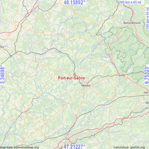
Port-sur-Saône GPS coordinates[2]
47° 41' 15.864" North, 6° 3' 0.396" East
| Map corner | latitude | longitude |
|---|---|---|
| Upper-left | 48.15892°, | 5.34698° |
| Center: | 47.68774°, | 6.05011° |
| Lower-right: | 47.21227°, | 6.75323° |
| Map W x H: | 105.3×105.3 km | = 65.4×65.4mi |
| max Lat: | 51.07786° ⇑46% North |
| Port-sur-Saône: | 47.68774° |
| min Lat: | ⇓54% South 41.3874° |
| min Long | Port-sur-Saône | max Long |
| -5.08615° | 6.05011° | 9.52242° |
| W 87.6%⇐ | ⇒12.4% E |
Elevation
Elevation of Port-sur-Saône is 231 m = 758 ft, and this is 37.3 m = 122 ft above average elevation for this country.
| Max E: |
2333 m = 7654 ft | 27.8% |
| Port-sur-Saône | 231 m 758 ft | |
| Avg. | 193.7 m = 635 ft | |
Min E: |
-1 m = -3 ft | 72.2% |
See also: France elevation on elevation.city.
Geographical zone
Port-sur-Saône is located in North temperate zone (between Tropic of Cancer and the Arctic Circle). Distance of this North polar circle is 2098.8 km =1304.1 mi to North.| Distance of | km | miles | from Port-sur-Saône |
|---|---|---|---|
| North Pole | 4704.7 | 2923.4 | to North |
| Arctic Circle | 2098.8 | 1304.1 | to North |
| Tropic Cancer | 2696.5 | 1675.5 | to South |
| Equator | 5302.4 | 3294.8 | to South |


Nearby cities:
15 places around Port-sur-Saône: (largest is in red/bold)
• Amance
12.6 km =7.8 mi,  3°
3°
• Breurey-lès-Faverney
9.7 km =6 mi,  38°
38°
• Combeaufontaine
12.1 km =7.5 mi,  281°
281°
• Faverney
9.7 km =6 mi,  24°
24°
• Frotey-lès-Vesoul
12.8 km =8 mi,  125°
125°
• Montigny-lès-Vesoul
5.8 km =3.6 mi,  163°
163°
• Navenne
12.1 km =7.5 mi,  136°
136°
• Noidans-le-Ferroux
14.9 km =9.3 mi,  208°
208°
• Noidans-lès-Vesoul
10.1 km =6.3 mi,  145°
145°
• Pusey
6.9 km =4.3 mi,  124°
124°
• Quincey
13.2 km =8.2 mi, 129°
• Scey-sur-Saône-et-Saint-Albin
6.2 km =3.9 mi,  244°
244°
• Vaivre-et-Montoille
7.5 km =4.7 mi, 147°
• Vesoul
9.7 km =6 mi, 134°
• Échenoz-la-Méline
11.6 km =7.2 mi, 146°
Sources, notices
• [Note1] Compared only with cities in France existing in our database
• [Src1] Map data: © OpenStreetMap contributors (CC-BY-SA)
• [Src2] Other city data from geonames.org with taken over terms of usage.
• [Src3] Geographical zone / Annual Mean Temperature by Robert A. Rohde @ Wikipedia
