Scey-sur-Saône-et-Saint-Albin geodata
Scey-sur-Saône-et-Saint-Albin (Bourgogne-Franche-Comté) is a populated place; located in France in Europe/Paris (GMT+2) time zone. With population of 1,614 people, there are 5787 cities with bigger population in this country. Compared to other cities in France, 53.7% of cities are located further ↓South; 86.8% of cities are located further ←West and 68.5% of cities have lower elevation than Scey-sur-Saône-et-Saint-Albin. Note1
Administrative division(s):
- Level 1: Bourgogne-Franche-Comté
- Level 2: Département de la Haute-Saône
- Level 3: Arrondissement de Vesoul
- Level 4: Scey-sur-Saône-et-Saint-Albin
Current local time in Scey-sur-Saône-et-Saint-Albin:
04:26 AM, WednesdayDifference from your time zone: hours


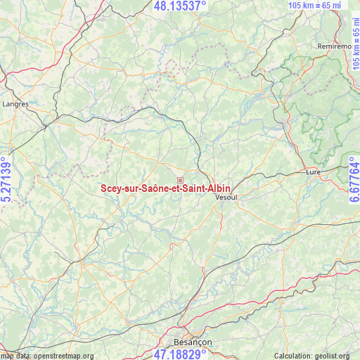
Scey-sur-Saône-et-Saint-Albin GPS coordinates[2]
47° 39' 50.328" North, 5° 58' 28.236" East
| Map corner | latitude | longitude |
|---|---|---|
| Upper-left | 48.13537°, | 5.27139° |
| Center: | 47.66398°, | 5.97451° |
| Lower-right: | 47.18829°, | 6.67764° |
| Map W x H: | 105.3×105.3 km | = 65.4×65.4mi |
| max Lat: | 51.07786° ⇑46.3% North |
| Scey-sur-Saône-et-Saint-Albin: | 47.66398° |
| min Lat: | ⇓53.7% South 41.3874° |
| min Long | Scey-sur-Saône | max Long |
| -5.08615° | 5.97451° | 9.52242° |
| W 86.8%⇐ | ⇒13.2% E |
Elevation
Elevation of Scey-sur-Saône-et-Saint-Albin is 211 m = 692 ft, and this is 17.3 m = 57 ft above average elevation for this country.
| Max E: |
2333 m = 7654 ft | 31.5% |
| Scey-sur-Saône-et-Saint-Albin | 211 m 692 ft | |
| Avg. | 193.7 m = 635 ft | |
Min E: |
-1 m = -3 ft | 68.5% |
See also: France elevation on elevation.city.
Geographical zone
Scey-sur-Saône-et-Saint-Albin is located in North temperate zone (between Tropic of Cancer and the Arctic Circle). Distance of this North polar circle is 2101.4 km =1305.7 mi to North.| Distance of | km | miles | from Scey-sur-Saône-et-Saint-Albin |
|---|---|---|---|
| North Pole | 4707.3 | 2925 | to North |
| Arctic Circle | 2101.4 | 1305.7 | to North |
| Tropic Cancer | 2693.8 | 1673.8 | to South |
| Equator | 5299.7 | 3293.1 | to South |


Nearby cities:
15 places around Scey-sur-Saône-et-Saint-Albin: (largest is in red/bold)
• Amance
16.5 km =10.3 mi,  22°
22°
• Breurey-lès-Faverney
15.5 km =9.6 mi,  49°
49°
• Combeaufontaine
8 km =5 mi,  309°
309°
• Faverney
15 km =9.3 mi,  40°
40°
• Fresne-Saint-Mamès
15.6 km =9.7 mi,  212°
212°
• Mailley-et-Chazelot
15.1 km =9.4 mi,  157°
157°
• Montigny-lès-Vesoul
7.9 km =4.9 mi,  111°
111°
• Navenne
15.3 km =9.5 mi, 113°
• Noidans-le-Ferroux
10.5 km =6.5 mi,  188°
188°
• Noidans-lès-Vesoul
12.7 km =7.9 mi,  116°
116°
• Port-sur-Saône
6.2 km =3.9 mi,  64°
64°
• Pusey
11.4 km =7.1 mi,  96°
96°
• Vaivre-et-Montoille
10.4 km =6.5 mi, 111°
• Vesoul
13.3 km =8.3 mi, 108°
• Échenoz-la-Méline
14 km =8.7 mi, 120°
Sources, notices
• [Note1] Compared only with cities in France existing in our database
• [Src1] Map data: © OpenStreetMap contributors (CC-BY-SA)
• [Src2] Other city data from geonames.org with taken over terms of usage.
• [Src3] Geographical zone / Annual Mean Temperature by Robert A. Rohde @ Wikipedia
